As part of the host of hikes pre-lockdown was this absolute gem, a full day of hiking originally intending to be a route up Skiddaw before sacking the route off due to high winds and zero visibility, and instead turning it into a memorable day collecting some of the less popular fells in the area. They might not be as high but still plenty of character.
Part 1 of the route for the day
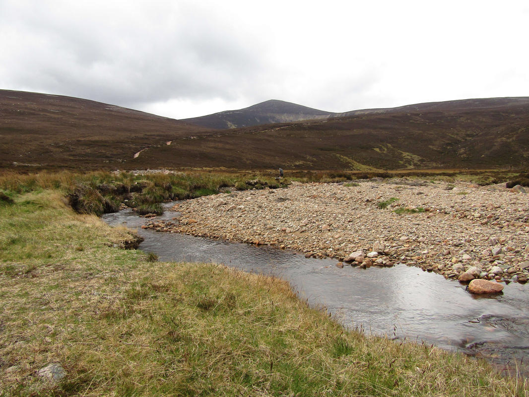
Lovely free flowing stream in Dodd Wood
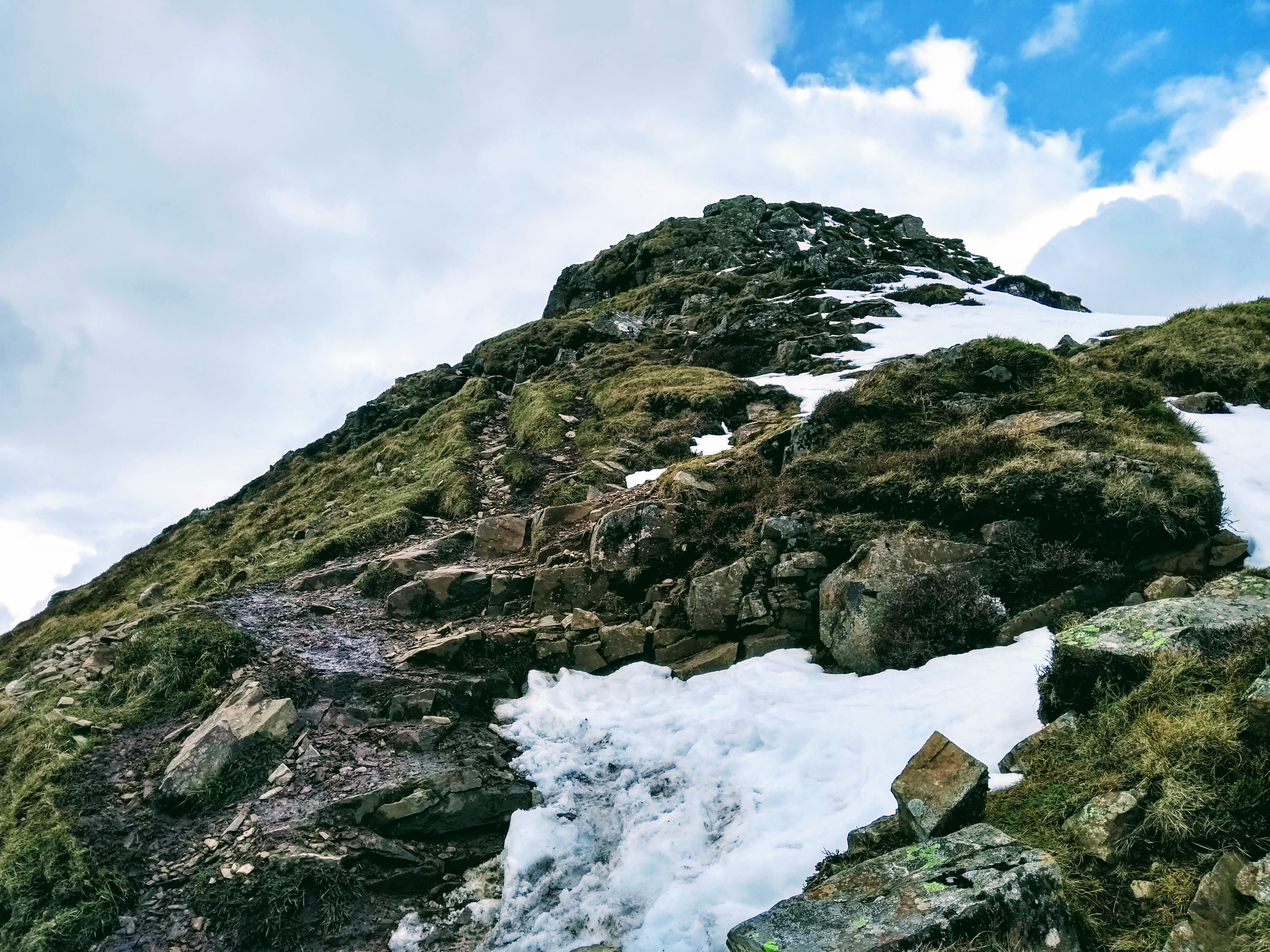
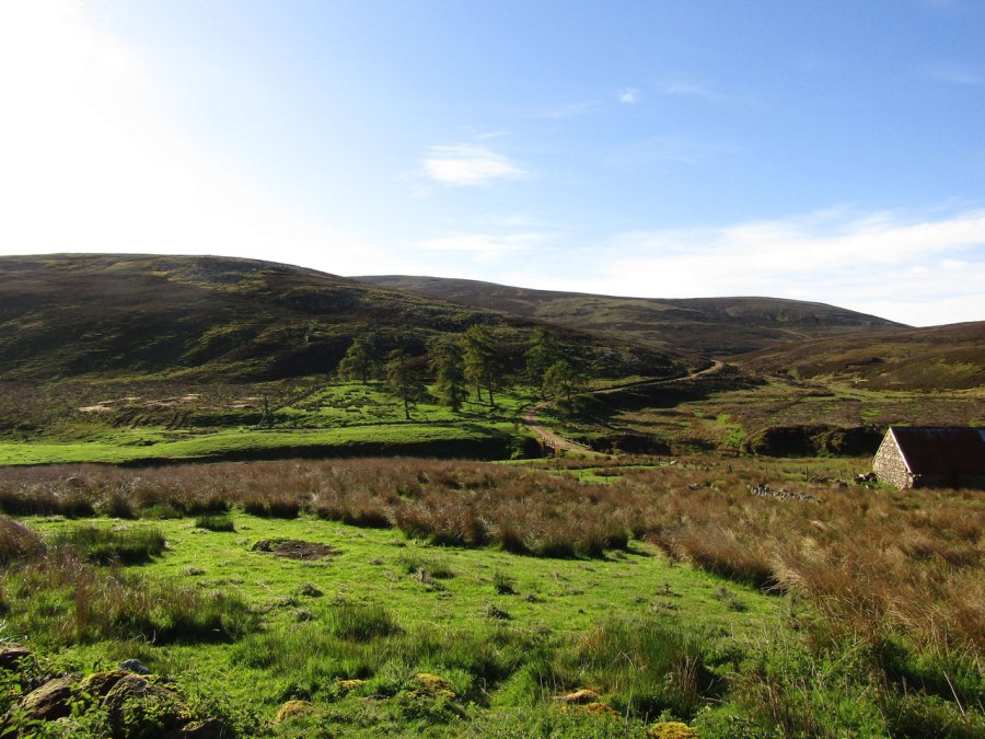
The morning brought a decent forecast for the day but an overcast, windy morning – and pulling on my boots in a small roadside car park close to the Ravenstone Hotel it was looking promising. The route began up the forest path to the start of ‘The Edge’, the named ridge which heads up to Ullock Pike.
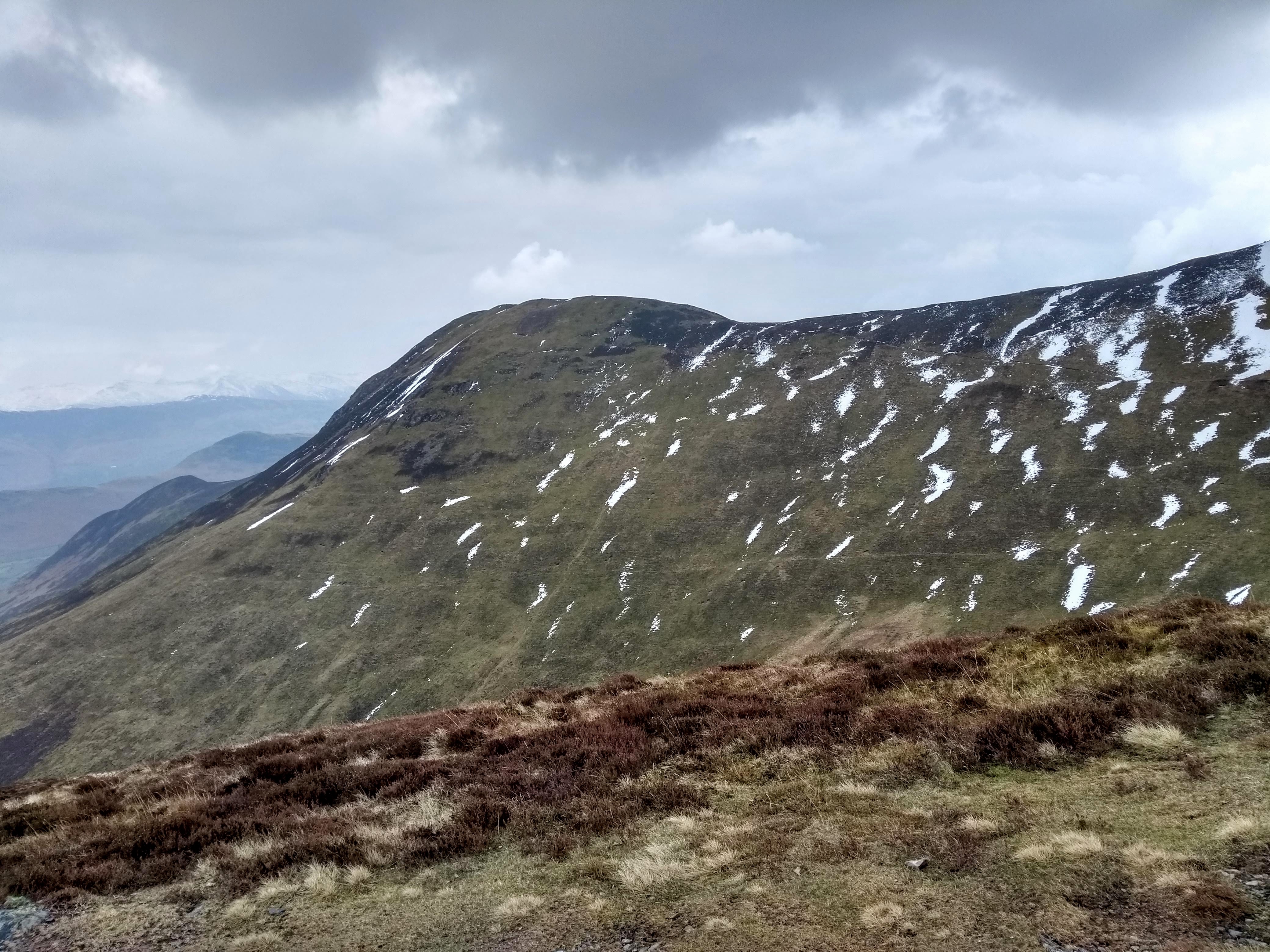
From Ling How, looking to the NW towards Barf across Bassenthwaite
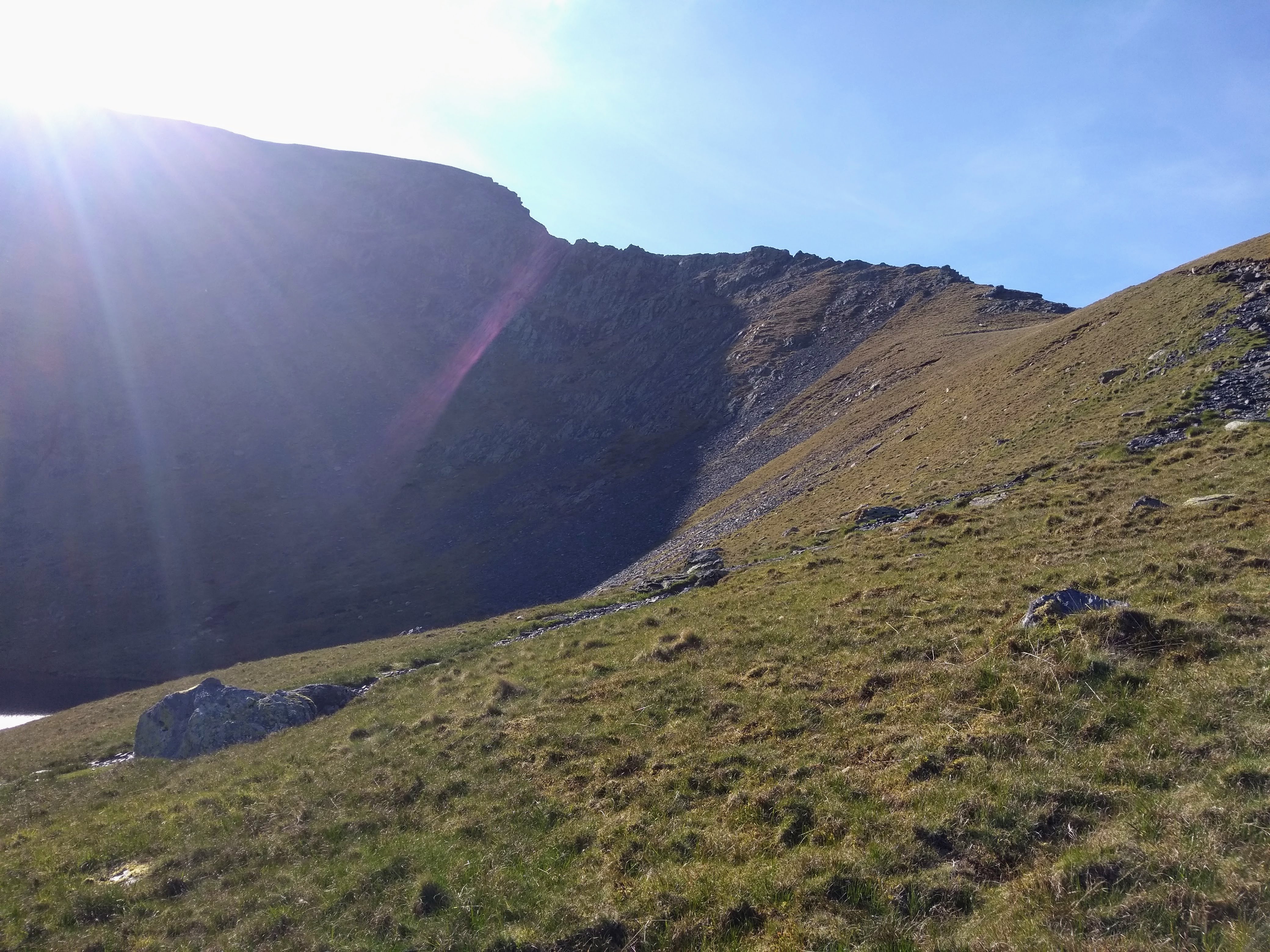
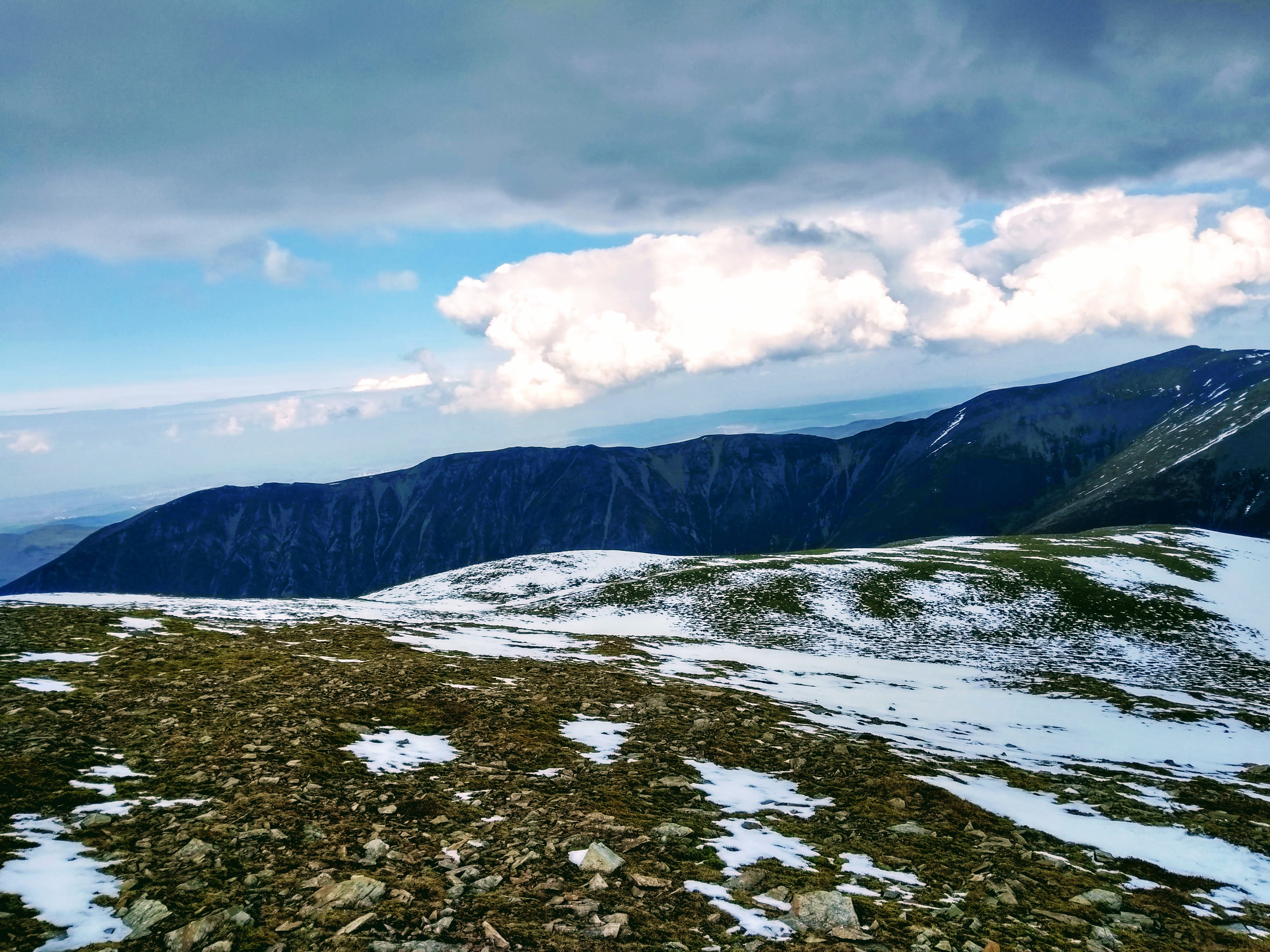
Upon reaching Ling How the wind was really blowing in from the west to the point where I was close to losing the hat off my head and it necessitated throwing another layer on as well as battoning down the hatches by tightening up my hood as far as it’d go. Unfortunately it started getting claggy at this point so most of the views became rather hazy. Longside Edge is quite characterful mind you, just not on those wet and windy days where you don’t get to amble around enjoying the views and instead put your head down and crack on!
Mist on top of Longside Edge
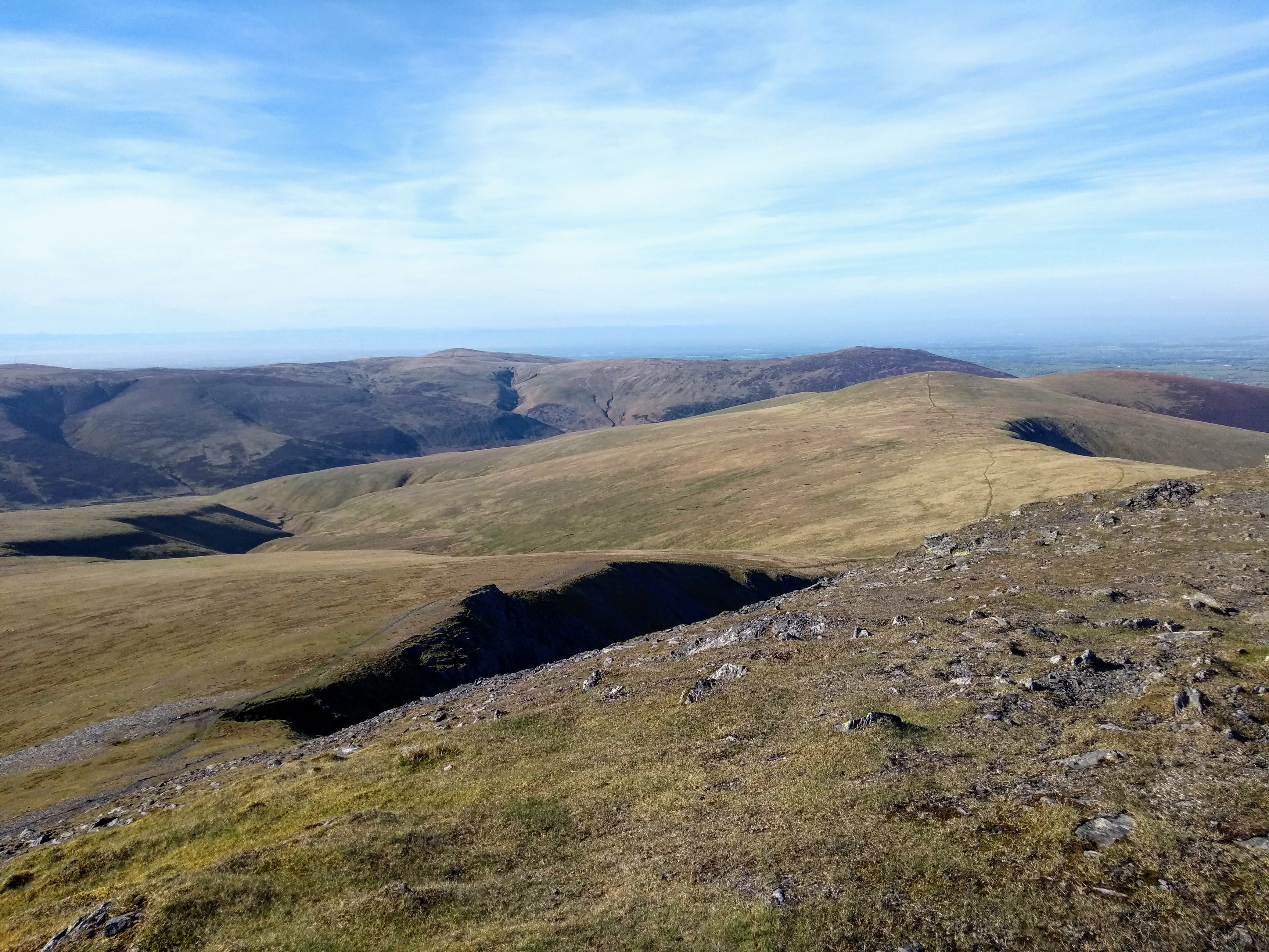
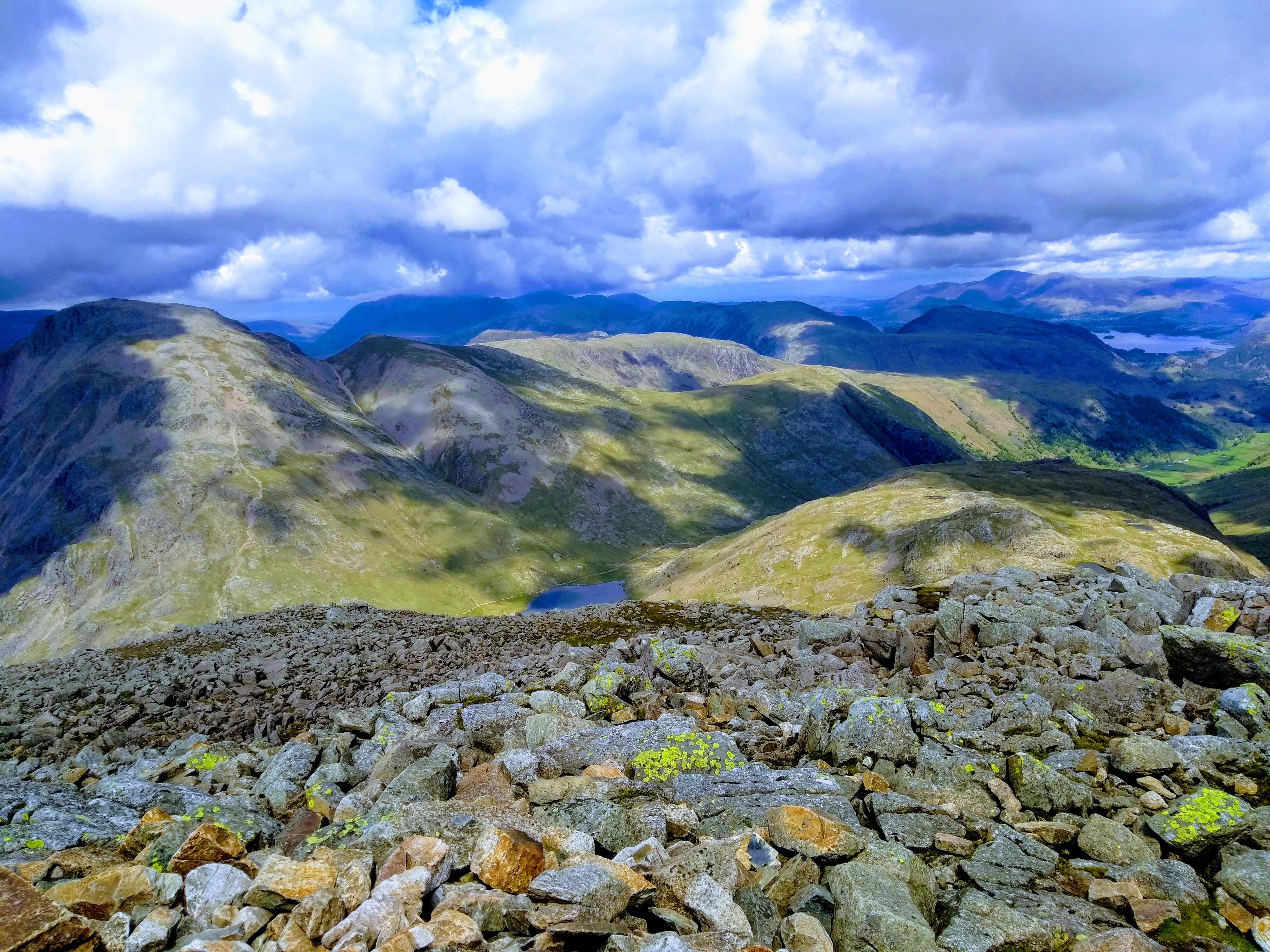
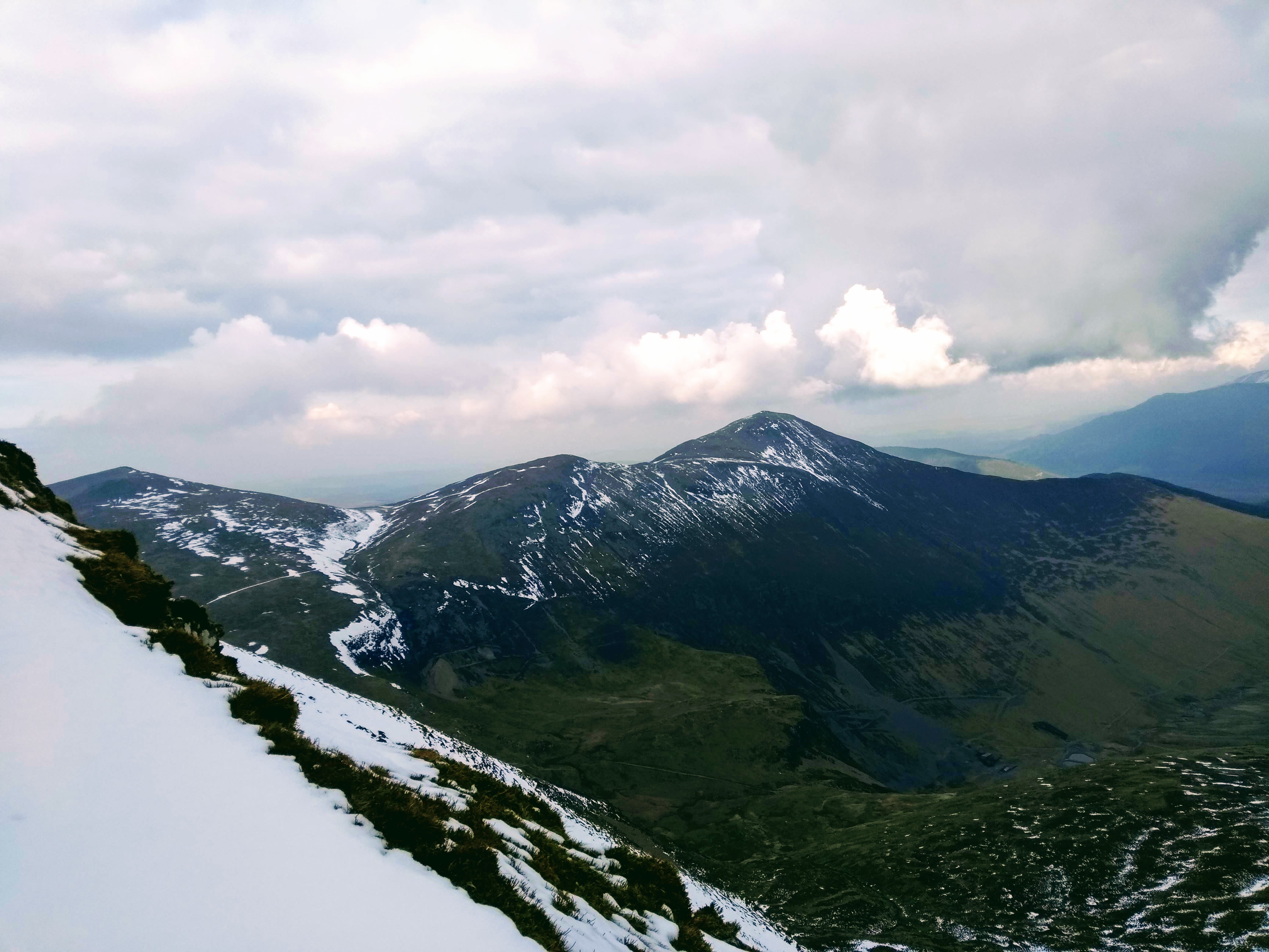
Longside opens out on to the open fell top, which runs gently towards Carl Side which hosts a leisurely summit which ordinarily would have been a rest spot before heading up Skiddaw. Today it didn’t seem worth continuining further up with the very poor visbility (and I’ve climbed Skiddaw with zero vis enough already) so I decided I’d go with a different plan for the day and started planning the new route. First I decided to head off the fell to the south and took the steep path which would head towards Dodd woods.
The Carl Side summit cairn
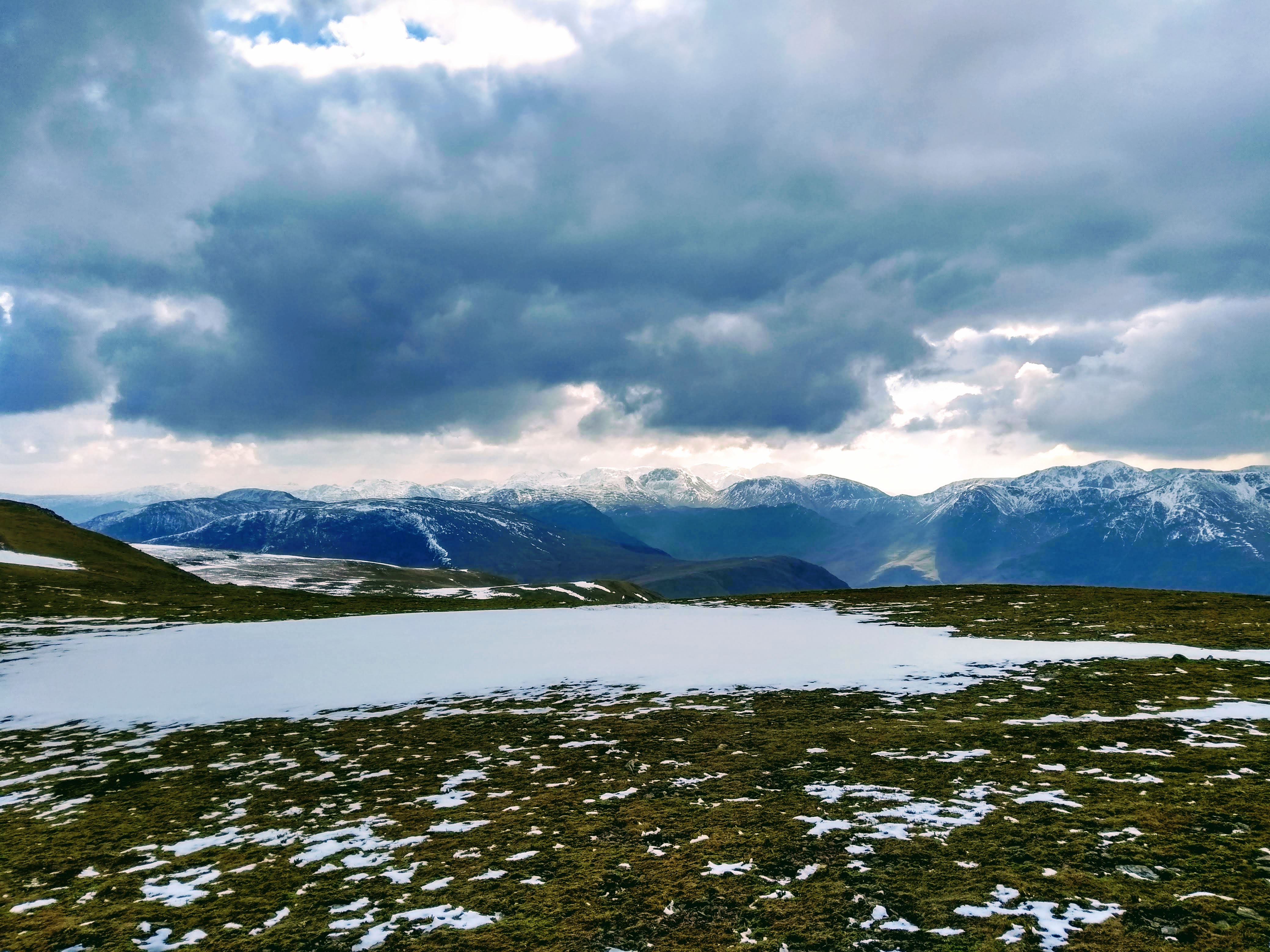
The wet path to the SW from Carl Side was both steep and slippery as I finally descended enough to emerge out of the mist – concentrating on keeping my footing in the full wind I passed a couple of walkers on their way up. It’s a path I wouldn’t recommend for the inexperienced, particularly in the wet. Towards White Stones as the path turned West a group of five or six walkers came past on their ascent, bravely deciding to head up a steep route and already struggling.
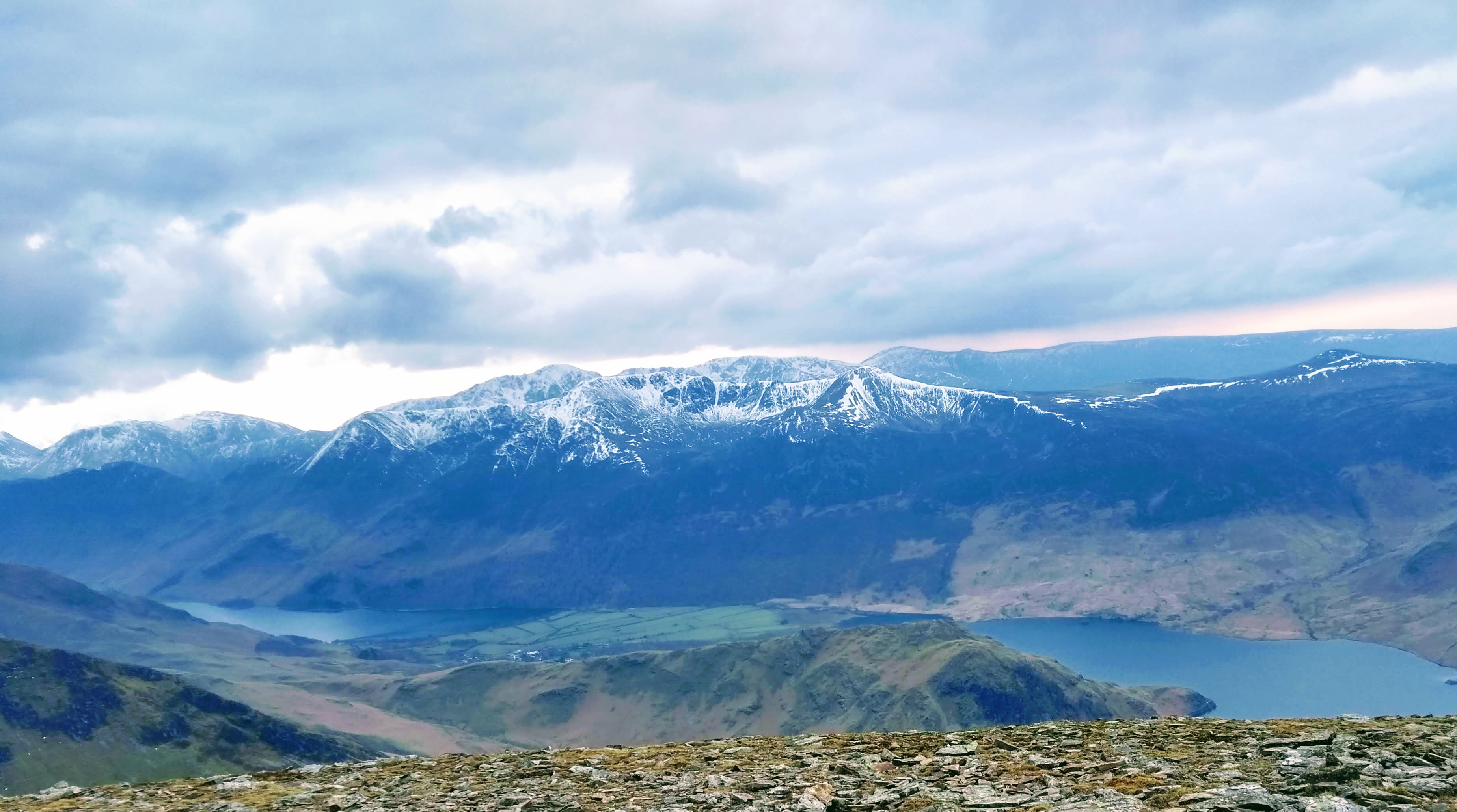
The lovely bench facing over Derwentwater and the pasture land between the Skiddaw range and those beyond
Slowly fining up
View towards Derwentwater
Towards Bassenthwaite to the NW
Misty descent from Carl Side
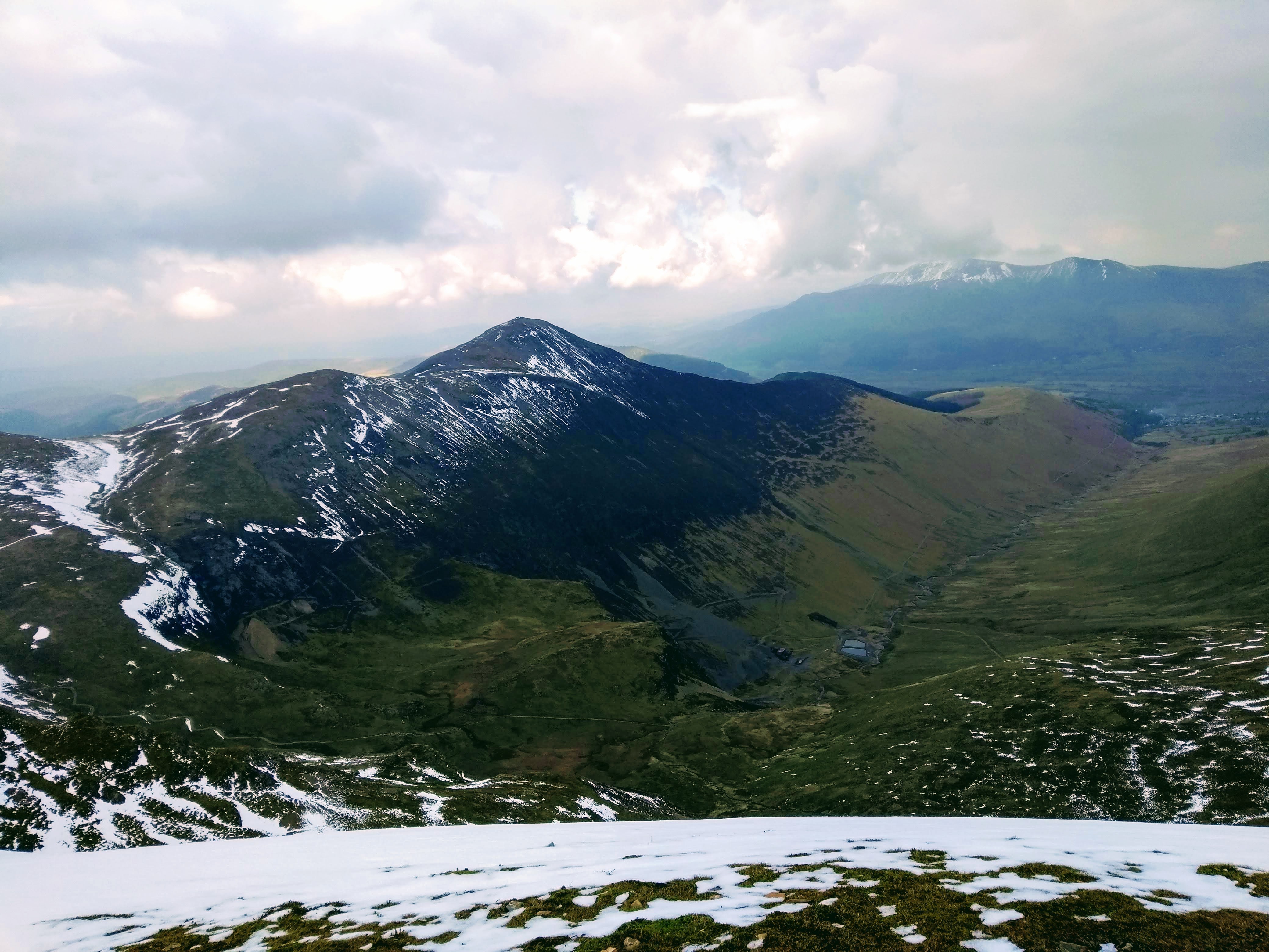
The bottom of the valley brought a respite from the weather and with almost perfect timing the sun came out as I headed towards Dodd, a pokey little fell hidden in the woods but at this point a far better plan, well protected from the wind. Dodd itself proved itself a brilliant little route and the view from the summit (well, a little mound at the top) provided a lovely view across Bassenthwaite, in my opinion on-par with the view from Barf on the other side (itself a much steeper climb and prone to waterlogging).
From the top of Dodd, looking across Bassenthwaite lake
Those who follow my blog will know I love a forest walk – and this proved a brilliant little distraction, sun out and gurgling streams making it impossible not to grin as I slowly wandered back to the parking spot. Well worth returning to this area and the route makes it quite easy for all ages and abilities (or mountain bikers if that’s your thing).
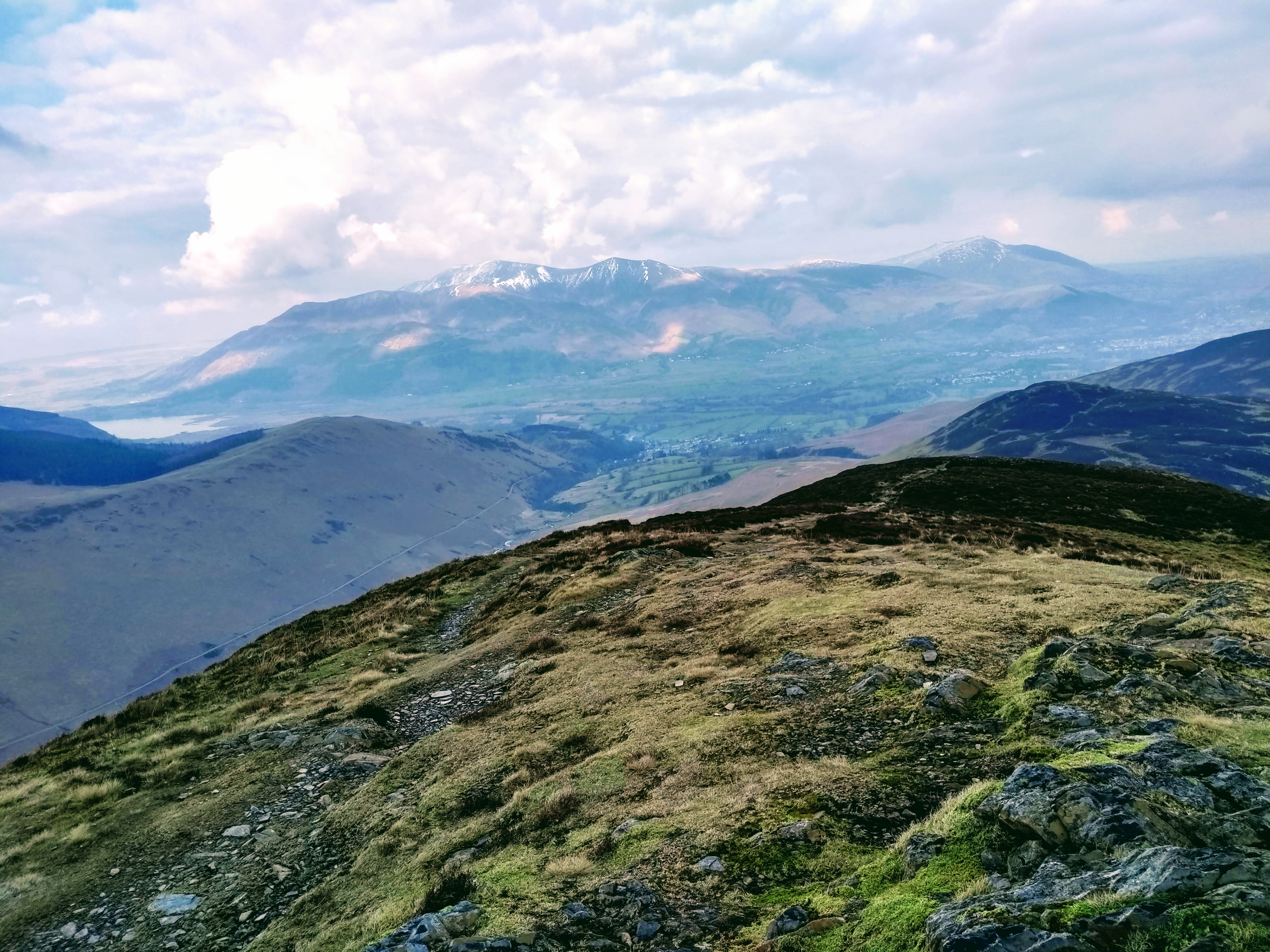
By mid morning the day was really fining up, and with my pack still stocked with food I made a beeline towards Binsey – the most northerly fell – and otherwise not a hill I’d ever plan a day out for as it’s fairly little and unconnected with any others. Not a huge amount to add other than parking is simple at the base of the fell on the roadside (see map) and this place was stowed out with walkers by the time I arrived. Once you amble up the easy route towards the summit the view is far better than the photos would make you believe. It’s also just around the corner from the Lake District Distillery if you wish to cap of your hike with a glass of something..
Binsey cairn
Lovely light towards Bassenthwaite
Binsey Trig Point
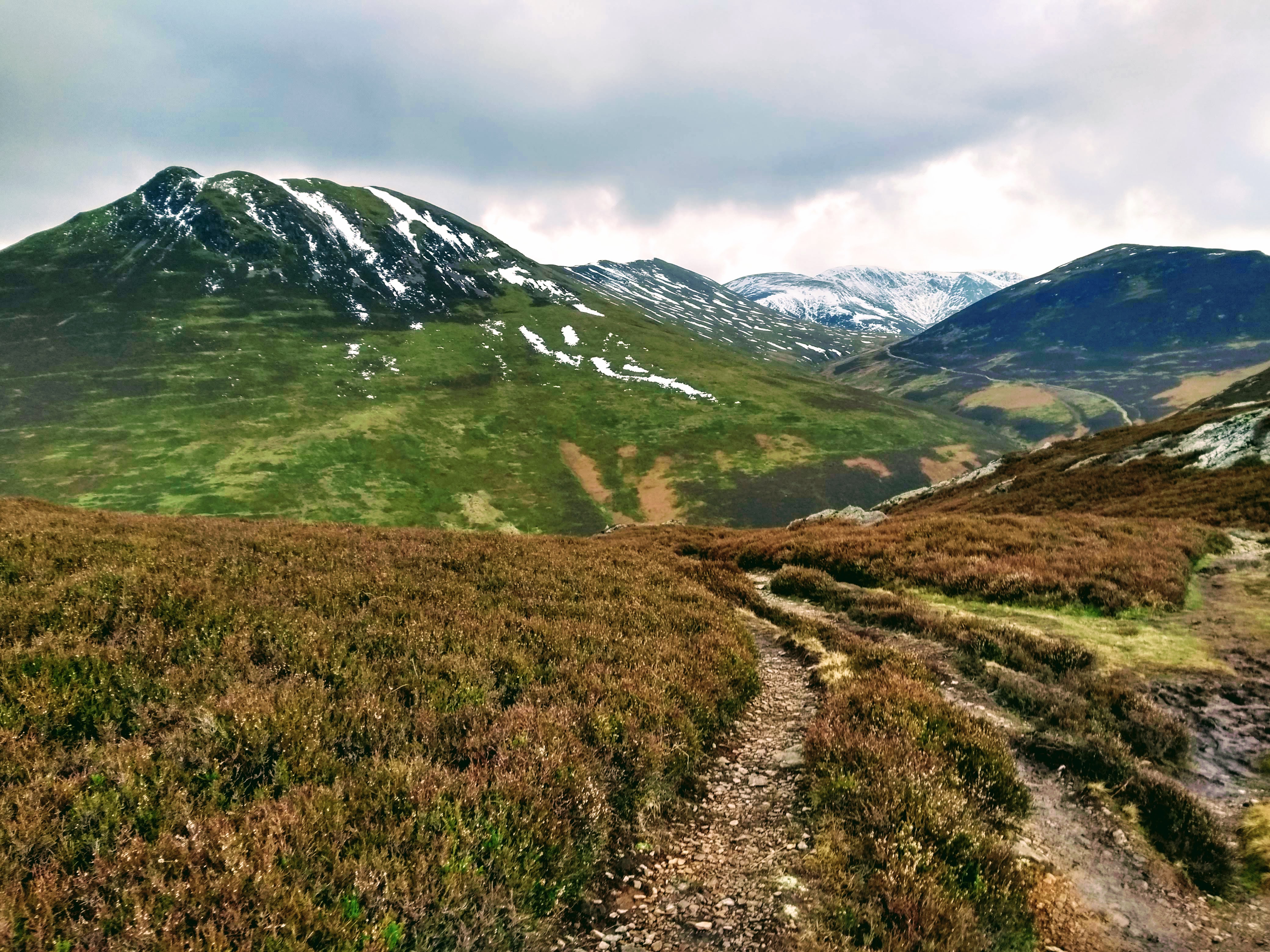
Walking down the hill, still fresh, I took a look at the map and thought to head towards Wythop Mill – a place I don’t know well but it seemed a good starting point for a couple of extra fells whilst I had plenty of energy. Ling Fell and Sale Fell are practically neighbours and by this point of the day there seemed a huge amount of cars around planning similar routes. Pulling up, it was time to head off again, by this time mid afternoon and shades on in the sunshine.
Clear path to Ling Fell
Summit cairn on Ling Fell
Alongside Wythop beck
The route up Ling Fell from being parked at Eskin was a simple one and I took the path heading up the east of the fell, it was a broad path, well marked and despite the wind still blowing it was far more pleasant than the morning. The walk down from Ling Fell along the track was stunning and arriving on the path alongside Wythop Beck as I ambled up towards Sale it was hard to not be thankful for changing my plans easier in the day as I was slogging up Skiddaw in the mist.
Sturdy wall heading up Sale Fell
Don’t detour through the gauze
Stunning gauze in flower
My phone had ran out of power by this point so pictures of Sale Fell summit weren’t possible despite the stunning weather and thoroughly excellent views from the top. Sale Fell also seems to have one of the most sturdy paths up of any fell in the Lakes – another one of those for the whole family. Great day out, finishing in beautiful sunshine and a new collection of the lesser-known tops explored.
I made the decision after several months away from the ‘proper’ fells to head to Blencathra – one of the easiest to access – for an evening view across the fells. Many are lethargic or frustrated at the moment, often with good reason, and this week it’s been a flurry of different thoughts for me – likely due to it being my grandfather’s first birthday since he passed. I felt I needed that ‘thinking space’ which gives so much clarity when out in the hills, and in the end was glad I took the opportunity.
Tarn Crags
Decided to start at Comb bridge and found the little car park almost full when arriving, making sure to cover myself in sun-cream (it was the warmest day of the year so far supposedly) and decided to head straight up the switchback. Fortunately I’ve been able to keep myself active during lockdown and fitness was no problem on the way up, only passing a single fell runner on her way down until I reached the tarn.
Once the ground levels out it’s a lovely little route, with the opposite side of the river Glenderamackin hosting an easy track I keep meaning to do but never seem to choose to walk it – a circular from Mungrisdale aiming to head up by Bowscale Tarn and ending with the Glenderamackin valley. Seeing the valley part of the route in full sunshine bumped it up my list. Also when we get back to ‘normal times’ starting and ending at a pub surely bumps it up a little more… after all they need business to recover, so it’d be rude not to help them out.
Side view of Sharp Edge
It’s also been quite some time since I’ve done Blencathra in good weather I made sure to slow my usual pace to force an easy amble, so I could really make the most of it.
View down to Scales TarnNearly there
Really took my time, enjoyed walking the ridge and was lovely having it to myself whilst looking down at the tarn in pleasurable conditions.
High Pike and Carrock Fell in the distance, Bowfell in the mid distance with Bannerdale Crags just visible to the right
Ended up wandering around the plateau a fair bit, ambled along to Knowe Crags just for a different angle and to make the most of the evening.
Stunning – across Mungrisdale Common in the foreground, with Great Calva and Knott in the centreKnowe Crags, Longscale Fell and the route up to Skiddaw with the Lorton Fells behind
Hard not to put your feet up for a few minutes and just stare
Clough Fell on the left, High Rigg, Castlerigg Fell and DerwentwaterAcross Knowe crags to the central fells
Found myself lingering up here, strolling backwards and forwards enjoying the sunlight. Stopped to have a chat with a couple of guys, one who quickly departed, but the other had a personal story about his recently passed wife which brought him up here, as he was there the exact same day the previous year – in some ways not entirely different from why I was there myself. Seemed a nice guy and wished him well, he was sitting down comfortably out of the breeze and looked to be set for an evening of sunset watching.
View back to Halls Fell. Superbly vivid bluesFrom Halls Fell across to Clough head, Helvellyn right in the centre distance
Really enjoyed the descent, easy little edges in the sunshine are a lot more fun than being battered by the wind barely two months ago on the same route.
Back up Halls Fell
Enjoyed the trip out, pleased to feel my fitness was at a good level and the conditions made it probably the most benign Blencathra trip I’ve done. If only we could wild camp, there was a pitch by the tarn which looked especially inviting..
Note: This is a trip walked in 2019 in those innocent, pre-coronavirus times. The current advice given for taking trips is to not travel outside of your home area except when necessary for food or medical supplies.
Seathwaite is the furthest village to the south of Borrowdale and this walk was one planned for a while yet shelved for a decent forecast due to how wet the Sca Fell area is. An excellent forecast meant the route was on and necessitated an early start to drive through Keswick and begin the meandering route past Derwent Water and down to the smaller lanes of Borrowdale, snaking past the lovely villages of Grange and Rosthwaite.
The little farm at Seathwaite gets a lot of foot-fall due to it being positioned at the start of many National Three Peaks routes to Scafell Pike as well as a fairly easy access to the three significant tarns in the area. There was barely two cars parked when I arrived though, and the prospect of quiet fells seemed a promising start to the day.
Great End in the cloud and Styhead Tarn
The route to Styhead Gill via Stockley Bridge is a well worn route and is covered with rocks to help with erosion, making it rough on the feet. The bridge is a precursor and an end of the flat easy amble and begins aggressively climbing before curving around after you’ve had a chance to enjoy views of Taylorgill Force, though on the day there was very little flow to speak of.
Corridor Route and Lingmell to the right
Styhead Gill has a lovely easy path which contrasts the ascent to it and lets you catch your breath as the views start coming in to focus as the tarn begins to gently glisten in the sunlight. Rarely, it was totally still and this made for a particularly tranquil little spot.
Looking back towards Base Brown and Seathwaite Fell
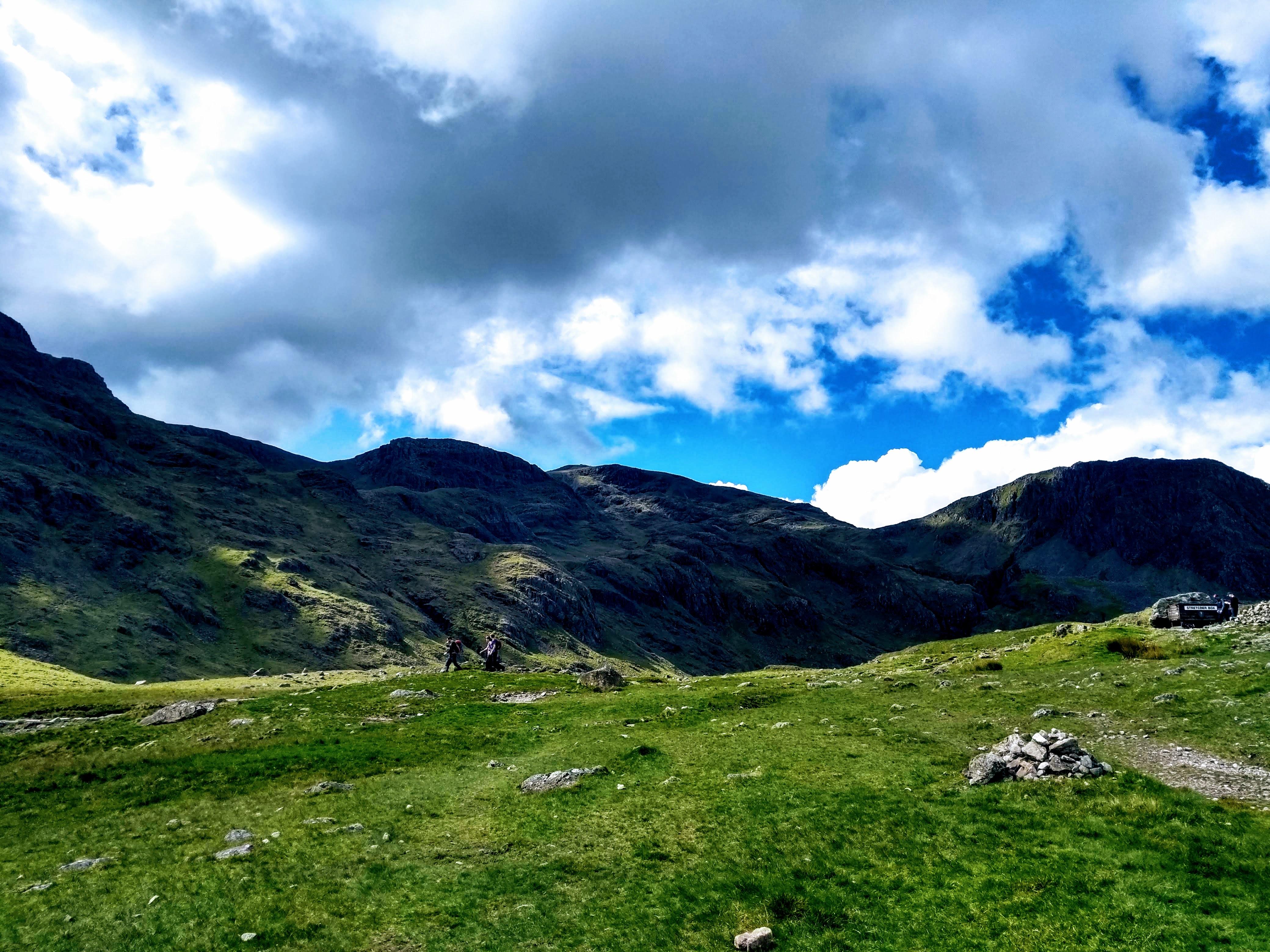
Heading beyond the tarn you take a little ‘jink’ which brings you around the Mountain Rescue stretcher box and on to the corridor route and on a clear day such as this it was stunning. The millions of tonnes of rock of Great Gable to your left as you climb in the sun’s shadow – negotiating a rewarding section of easy scrambling in parts, heading past the iconic Piers Gill (a frequent wrong turn taken by walkers descending).
Towards the end of the Corridor Route
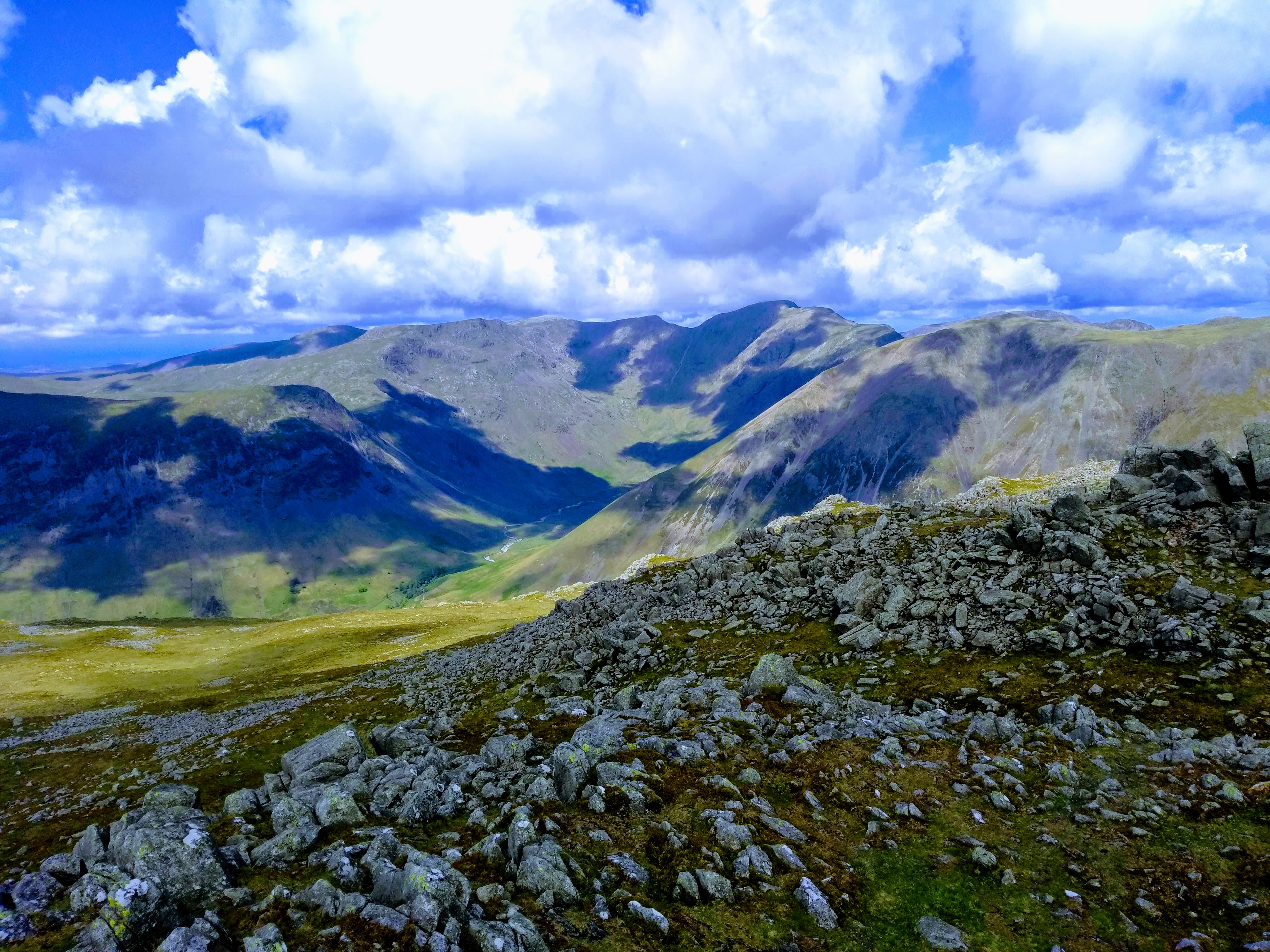
I wasn’t intending to do Lingmell on the day but conditions meant it was so tempting I couldn’t help but find myself heading over the (still slightly soggy) col and heading up to the cairn. The fairly unassuming ascent hid an absolutely stunning view from the top and I ended up taking a short break here, totally out of sight from anyone with the valley opening out before me to the north.
Looking towards Wast Water from Lingmell
Looking up Mosedale
The interesting rocky outcrops in front of Great Gable’s shoulder, looking towards Styhead Tarn in the distance and across the central fells
Piers Gill in the sunlight on the way back over to Scafell Pike
On the way down from Lingmell I noticed a steady stream of walkers on the Wasdale path slowly making progress on the firm steps – presumably all the way to the summit, though some were taking breaks in the sunshine and were struggling with this part of the route. This marked an end to the solitude of the morning and I was passing a fair few of these groups on the way up – people from all over the world had decided it’d be a good day out, some stopped and watching a couple of fighter jets which were likely on a training flight nearby. Scafell Pike was in full sun and to put it mildly was ‘quite busy’ with many choosing to linger after their exertions. A proper lunch stop was had and I took the unusual step (for me) of taking ten minutes just enjoying the summit, sat there watching the world go by.
Not exactly the summit to myself
From Scafell summit
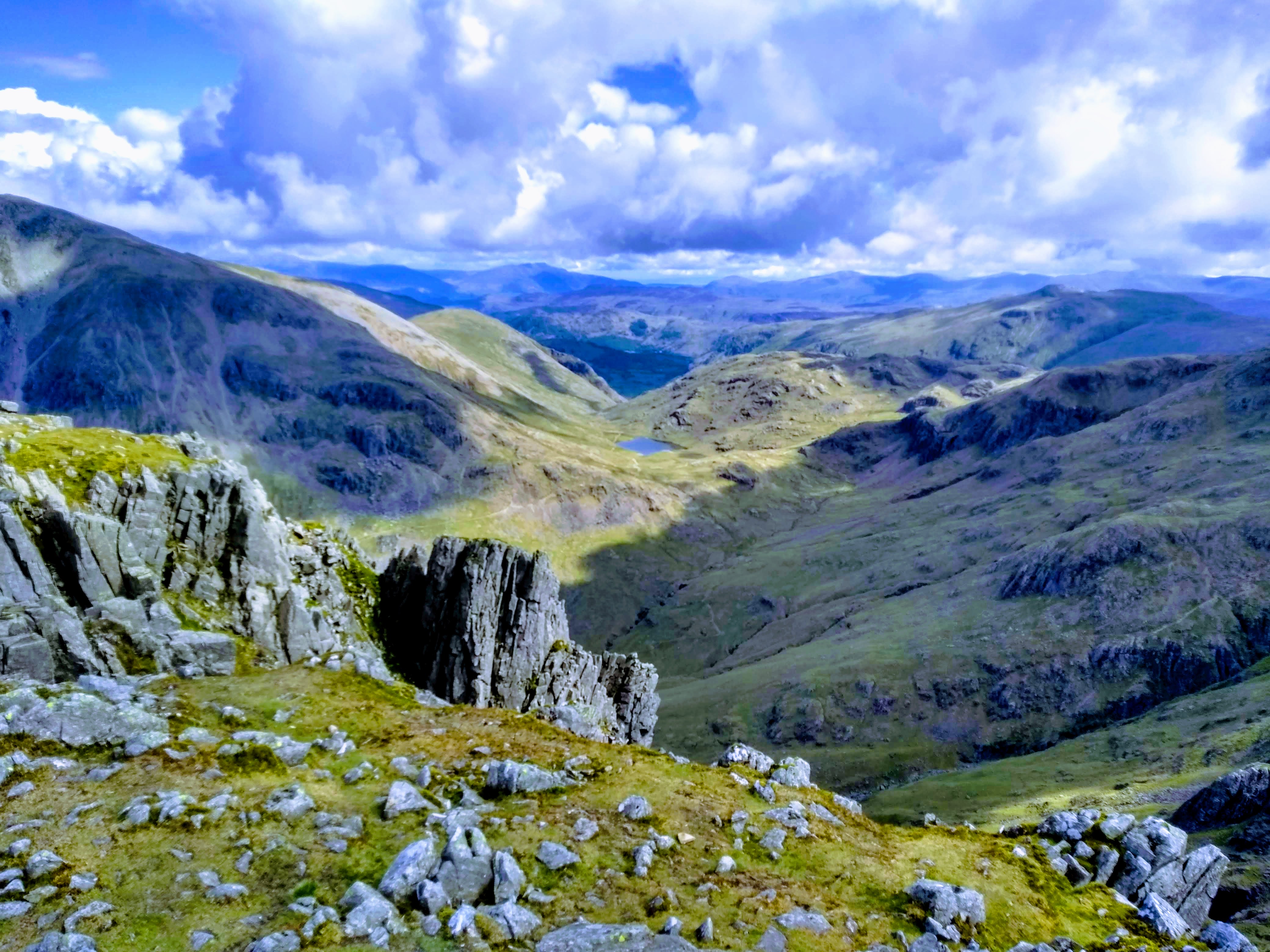
Once I felt a little recharged I took the path to the north east towards Broad Crag, a fairly steep and scree-covered descent which reminded me of the west side of Fairfield (my last episode of unplanned rock skiing). The path made a gorgeous route and headed towards Great End, the peak which had dominated the view when approaching Styhead Tarn earlier in the day – though was much more manageable from the south with most walkers seemingly choosing to walk straight past it – giving me the summit to myself. Stunning.
Derwentwater to the top right of the picture
Sprinking Tarn and the fells beyond
It was approaching mid afternoon now and I knew I wanted to keep making progress so ditched Esk Pike (one for another day), instead choosing to head to Esk Hause where the weather really started turning – high winds and heavy rain started coming down and full waterproofs were donned. I’m not usually a fan of waterproof trousers but when the rain is as heavy as that they made a difference, and I passed a few of the under-prepared walkers looking rather sorry for themselves on their way down towards Sprinkling Tarn. Definitely a lesson many of us take a few attempts to learn, but I’ve concluded always bring waterproofs (at least a light jacket) in the UK. Your optimism is not enough to repel water!
Esk Hause
Grains Gill was tempting but feeling quite fresh I decided on Allen Crags to the north east, putting a few more miles in to my (now rather tired but unbelievably comfy) hiking boots – a decision which pushed me away from the busy routes and gave me the fells back almost entirely to myself. This boggy area north of Allen Crags was lovely to walk through, reminding me a little of High Rigg in its undulating character with a few pools and mini tarns scattered around. By this point most of the rain had abated but it was still sporadic, tempting me to put the waterproofs on again before I’d overheat ten minutes later.
Imposing view back to Great End – dodging the showers
Glaramara loomed ahead and I was feeling a little weary, having not taken a break since Great End and feeling a need to change my soggy socks after a wrong step in a particularly deep bit. A few minutes on the summit relaxing out of the wind game me enough energy to decide to attempt a down-climb on the slippery scramble on the north side of Glaramara, in retrospect probably not a great idea to do over slippery rock but it brought a bit of variety in to the day.
Glaramara’s rocky outcrap – weather fortunately keeping fine
The last Wainwright of the day done and sun back out I was glad to be dropping off the tops and away from the worst of the southerly wind, though the route I was itching to do over Raven Crag and down to Combe Gill was probably a little too far – and instead the steep descent alongside Hind Gill seemed a faster way back to Seathwaite.
That said as the topo-map suggests this is an especially steep, slippery route with wet grass making it something which needed caution, though the gill itself did hide some beautiful little mini crystal clear waterfall features and I restocked my water bottle a few times with this mana, the previous few hours having little in the way of water I wouldn’t have had to filter.
On the way down from Glaramara
Fields of sheep approached and I had finally moved off the steep bit, joining the main path and heading back to the farm – the car park areas now full of those enjoying a day out in the fells. Excellent day out and despite some showers the majority of the day was superb.
Wainwright wrote that many of the hills on a Coledale Horseshoe were much quieter than their high profile northern fells counterparts such as Skiddaw and Blencathra. Much of the second part of this route definitely had that quieter feel with little paths meandering gently through the heather, not quite busy enough to bring the attention of the Lakeland authorities wanting to shore them up with scree (just yet at least). Being as it was the end of the winter season it was possible to get many fells entirely to yourself, too, encouraging you to linger and enjoy the views as they gently unfurl the higher you climb, accompanied by just the gentle sound of the wind and crunch of snow underfoot.
Just starting the day: looking across to Bassenthwaite
It’s been quite a while since I’ve posted a trip report and I’m sure some of you who followed me when I was writing my TGO Challenge Diary will wonder who on earth this is again and why you’re getting an update in your inbox! (yes, that was back in 2017!).
I’ve been walking fairly consistently since, of course – but in general found doing the trips a lot more fun than writing about them. That being said, this trip was a particularly amazing route which rekindled that love of waxing lyrical about the great outdoors, so I hope I’m not too rusty to make it a compelling read…
Now, for those who haven’t read any of my trip reports, they’re typically pretty long – I write primarily as a trip diary to remember all the little bits I loved about day out, and unapologetically included plenty of photos this time to break it all up, especially due to some of them being absolutely stunning – so if you like that sort of thing, grab a beverage of choice and scroll on…
Already stowed out, around 8am
The Coledale Round (a ’round’ or ‘horse shoe’ is a route which starts and finishes at the same place without retracing its own route) has been on my list for a while now, though Grisedale Pike in particular for some reason has kept eluding me. We’ve had non-stop gale force winds for weeks (months?) with three ‘named storms’ coming in and dumping a massive amount of water, so this was the first forecast for months with clear sky and almost no wind – so I decided I’d get out there, put the boots on and see what the Coledale valley was all about.
Lovely light. Skiddaw in the background
Parking at Braithwaite it was a stunningly beautiful blue-sky morning, I thought I’d be one of the first on the fells but the car park was already near full with those who had thought the same about making the most of the break in the weather. Ascending steps from the car park immediately starts the climb through woodland towards Kinn, the first mini hill of the day. That morning I was lucky enough to be serenaded by birds enthusiastically chirping away their morning song as my legs were warming up for the day. It was that kind of bright, still-winter morning where you’re looking everywhere and enjoying how the world looks with those long, luxurious morning shadows and I mercifully had this section all to myself with nobody even in sight. It felt incredibly fresh, every breath making you glad to be outdoors.
The stunning view of Crag Hill and Sail blanketed in snow after cresting the first rise
The route slowly curves around and then levels out to this little alpine-style section with grand views of the Crag Hill at the head of the Coledale Valley, still coated in sun-kissed snow – all the while admiring the beck running along the valley floor below. I’m not sure if it was due to knowing I’d be climbing them later in the day, but the hills did look particularly stunning – with clear views to Skiddaw to the north, Blencathra to the north east and across the Whinlatter Forest to the north east once I gained enough height to see it bathed in full sun.
Looking back to the path taken, and Derwentwater and Keswick in the background
Sleet How came next, the scrambly section which was fortunately in full sun and so only still held a few slippery sections of consolidated snow from walkers boots. It was a fairly steep sustained section and I caught and passed a walker at this point, stopping for a chat (truth be told we both didn’t object to a breather). Apparently he was also trying a Coledale round but was ready to cut it down if he ran out of steam later. We wished each other a good day out and I cracked on with the ascent.
Stunning backdrop to the rocky section of Sleet How
This section was particularly beautiful when it came to views once above the snowline, the views towards Ladyside Pike and Swinside to the north west were framed majestically, the blues of the sky mixing and reflecting from the snow and ice, giving so much more character to the fells than you’d usually see with the mix of browns and greens you’d see on a normal summer day.
Stunning light reflecting off the snow
Contuining onwards there was one of the absolute views of the day, the rocky contrast with what was underfoot and the soft snow in the distance. This was a truly beautiful section which made this walk one of my absolute favourite days out in the Lake District so far.
Incredible place to stand and stare
Proceeding from Grisedale Pike itself, I was uncertain whether I’d include Hopegill Head when planning the walk – it would add a little distance and I conscious of the strong winds we’ve been contending with for weeks. Originally I thought I’d save it for another day and tie it in with another walk from Crummock water… but with the views on offer I kept going with a spring in my step, enjoying the slow, easy downhill with Hobcarton Crag to the north, spoiled by views of the Whinlatter Pass and its’ surrounding forest.
The view back to Sail and Crag Hill
A few sections of hard ice escaped the thaw
The route has a lovely gentle downhill which curves around to the north west, allowing you to see up to Hopegill Head and the lovely craggy aspect to the side of it – where a single figure was standing and looking down at me making my ascent. By the time I was at the top they were nowhere in sight, but this particular hill has a lovely aspect of an area I’ve not normally had much experience of – the pics are included below, I couldn’t leave them out!
View to the north, Ladyside Pike and across the Whinlatter Pass to the Lorton Fells
View towards Hobcarton with Grisedale Pike at the top of the ridge
Detail of Hobcarton Crag
Looking north west towards Hopebeck with Dodd to the left in the distance
I grabbed a few bites of food in preperation for the drop down to the Coledale Hause and the climb back up again at the south side of the Coledale valley, the Hause being a saddle (natural low point) between two sets of hills and especially well protected from the wind were you looking for a camp spot. On such a still day this made little difference of course, however Grasmoor (which I wasn’t going to do on this walk) looked incredible and I just had to add it to the route..
The view to Grasmoor
The route down was covered in scree, which made for a bit of a jarring descent and I kept to patches of snow where possible, glad to have my hiking poles to help the knees a little. The stream (which becomes Liza Beck) was in full spate with the snow melt running off the tops and I took a moment here to refill water bottle and stripped down to just a base layer in preparation for a sustained climb from the bottom of the Hause all the way to Grasmoor’s cairn.
Grisedale Pike in the distance from the NE aspect of Grasmoor. Quite a lot of neve (hard snow) making progress difficult
At this point there was a veritable explosion of walkers arriving from other directions, with a series of people appearing from the route to Wandope Moss to the south in the opposite direction. I had been enjoying the solitude so far and decided to keep it by hurdling the stream and taking the north-east aspect up to Grasmoor which still held plenty of snow. This made for heavy going but gave an opportunity to practice some boot techniques as well as that lovely feeling of walking over untouched snow with no boot prints whatsoever. At 750m the crispy snow turned to hard neve as it had refrozen – making kicking steps a necessity all the way up and needing steadily increasing effort. I made the decision to not carry an ice axe on this trip as the snow melt had been rapid so normally I’d not want to ‘practice’ on hard snow without, but the run out was gentle and decided to use the opportunity to get the microspikes out to make progress over this short section and keep climbing towards the Grasmoor’s cairn.
Whiteside, Gasgale Crags and Hopegill Head to the right
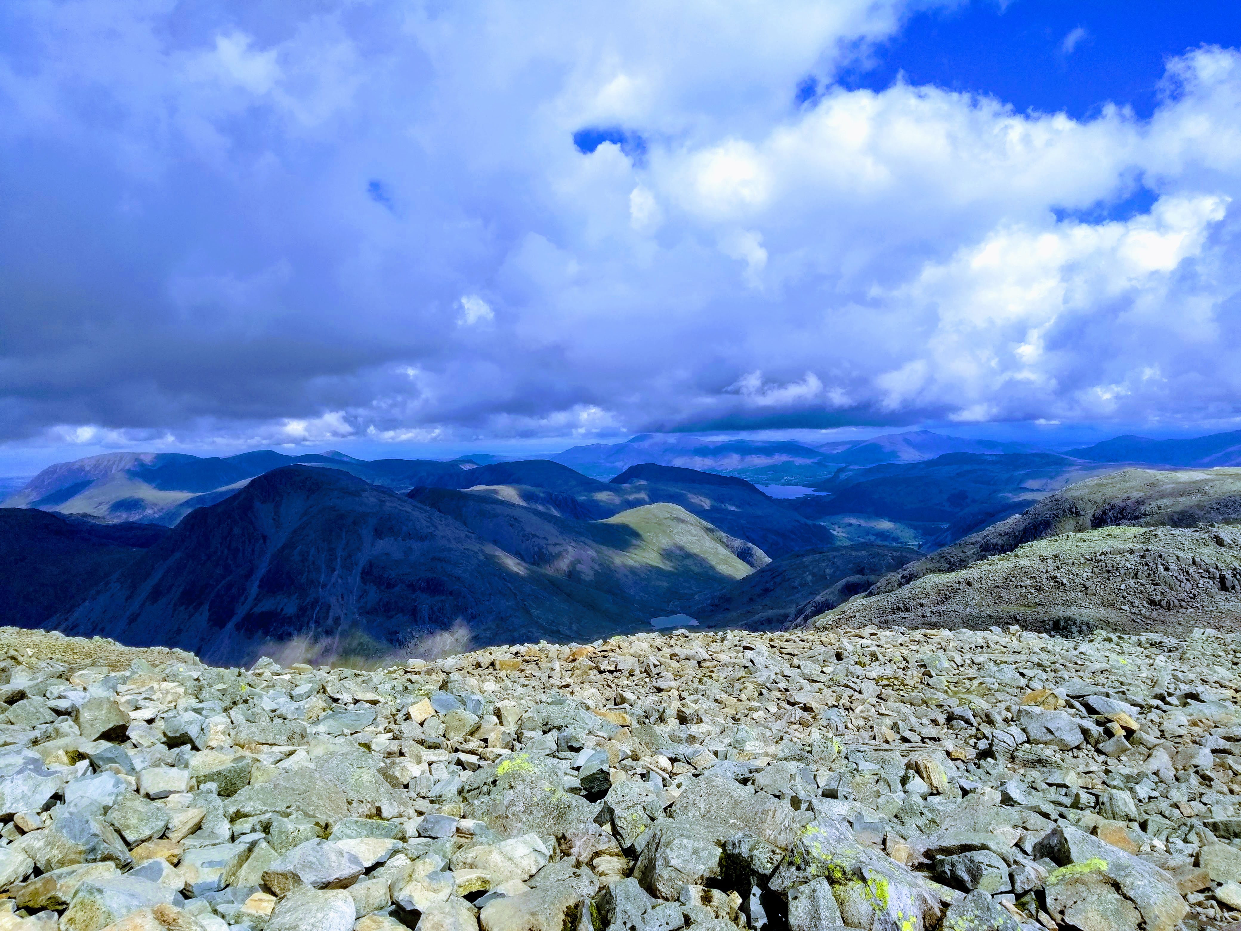
After reaching the top of Grasmoor the expansive view to the south of the Buttermere fells cleared and I could see Great Gable with Scafell Pike in the distance. For a March day the views were brilliant. I took loads of pics, a selection of which are below:
The major South Western fells appear in the distance
Dove Crags holding snow
Whiteless’ Pike ridge with Great Gable framed in the background
Lovely view of Buttermere’s range and Crummock water on the right
Perched looking over both Buttermere and Crummock this seemed an ideal time for a long leisurely lunch stop, though I began to chill and noticed a cold front had moved in, likely dropping the air temperature to around -1/-2C that high up. I had been moving rapidly all walk so far and only needed a Power Grid base layer, adding my fleece and windproof for the stop.
The best way to warm up is always to move of course and as I turned around to hea dback I made a mental note to get myself back to Buttermere soon (..seem to do this every time I’m near Buttermere, it’s a lovely place) and decided to head towards Wandope, first descending Grasmoor’s eastern aspect via a snowy downhill with deep plunging steps before continuing a slow plod in the slippery footsteps of walkers on the way up to Wandope itself.
Scar Crag
This part of the fells, now around lunch time, was the busiest I’d see the route all day – Coledale Hause acting like a hub for walkers coming from the Derwent side to the east, Buttermere to the south, Crummock via Gasgale Gill and the few walking up the Coledale valley route. I wanted to get moving and find some space to myself, so engaged the afterburners and flew up Crag Hill and enjoyed a quiet summit away from the cairn – contemplating just how lovely the route had been so far and relishing the undulating aspect of the second half of it to come.
Grisedale Pike to the centre with the Coledale valley visible clearly
The route yet to do – Outerside, Stile End and Causey Pike visible to the south side of the valley
Crag Hill marked most of the hardest walking of the day done, however a series of wainwrights still were tempting me – my thinking when planning had been that I’d see how fresh I felt and add or remove them if I felt any significant fatigue. It hadn’t been that long since my calf injury which had me on crutches for a while so I wasn’t wanting to persist with pushing it if anything felt ‘wrong’.
Ridge after ridge, after ridge.
Scrambling down The Scar wasn’t too tough with a couple of slightly icy areas of compacted snow, however the walking poles made for quick progress and I was soon negotiating this lovely little saddle before Sail itself, itself covered in snow with the valleys beginning to open up their views on both sides.
Looking back up at The Scar
Clear view of where we’ve come – Hopegill Head and Grisedale Pike behind
Lovely view back up the valley
Finishing the snowy little ridge after Sail I took a minute to strip a layer off and climbed Scar Crags quickly. Even though it was holding more water than the rest of the route so far, this hadn’t registered much due to enjoying the solitude in an area which seemed much quieter than the busy ‘walking hub’ I had come from. Presumably most walkers had taken the Coledale beck route back.
Scar Crags and Causey Pike ahead with Rowling End jutting out to the right of it, Derwentwater peaking out in the background
I had been intending to just walk straight north west from Scar Crags to rejoin the path, but took a look at ground conditions with a steep icy run off on boggy, slippery ground and thought the better of it. In many ways often these ‘short cuts’ on the map are often worth resisting, by the time you’re checking your foot placements to avoid a slip you’re committed to a lot more than you needed to be – far better to keep a little safer, pick the slightly longer but faster route without any dramas!
Good view of the mine workings to the left, with the path downhill by the scree to the right
This proved a wise decision as the route to the north of Scar Crags was holding a fair amount of snow and the descent had become a slip-and-slide experience where you try to avoid the icy patches which had been compacted by other walkers. I was passing several groups of slower walkers who didn’t have poles and couldn’t seem to stay upright for very long!
Still feeling fresh I crossed over towards Outerside to tick off another Wainwright – though the High Moss area (the clue was in the name!) was a fairly extensive bog which took some careful stepping around to avoid going ankle deep. I hadn’t brought the gaiters this time so I was being extra careful. There’s nothing which makes an otherwise brilliant day go sour than immersing your whole boot and finishing the day with cold, stinking feet.
View from Outerside. Bassenthwaite and the Skiddaw range clearly visible
Looking across to Causey Pike, pretty much the same level
The view back, – heather in the foreground and the crag of Causey Pike on the left, Scar Crag, Sail, Crag Hill and Outerside on the right
The round was coming towards a close but not until I had included Barrow – a hill I’ve not visited before. I was considering cutting the day short here and coming back to do Barrow later if there was much more snow and going had been slower – but I felt fresh, still had some food left in the pack and so set off for Barrow without a second thought, passing a couple of surly fell runners on the way.
Upon topping out there was a short intake of breath, as for quite a little hill there was a lot to enjoy about it. The aspect across Derwentwater, the general panorama allowing you to stare at Bassenthwaite, the Whinlatter tops and generally spend a moment contemplating in any direction you choose. I’ll definitely be back – though probably with more company since it is fairly easy to get to from Derwentwater’s shore on a sunny day.
Stunning view across Derwentwater from Barrow
Bassenthwaite from Barrow
After a proper break here (the last one had been on Grasmoor) I packed up and meandered slowly behind another set of walkers back into Braithwaite. I’ve hardly explored here much in the past, usually just passing through – but there seems quite a lot there for a small place. Obviously very dominant with holiday cottages, but two pubs, a village shop and a village restaurant isn’t a bad haul for what is a little place!
Ambling down to Braithwaite and the trip home
Overall a superb day out, loved the route and well worth the my delay in getting to actually do the walk. If anything the thawing snow gave it a lot more character and colour than the summer would have done, not to mention having many of the hills almost to myself. This walk also saw me pass the ‘half way point’ of a Wainwright round of 214 fells and I seem to be enjoying them more and more lately, especially with many of the far western fells remaining which are typically a bit quieter.
I’ve decided to include much less text in these trip reports and a lot more photos – I take loads of them, so why not! Let me know if that’s something you appreciate. Occassionally I’m very tempted to go off on a tangent about gear choices, navigation and so on, but at the end of the day that’s pretty niche stuff and only really relevant during the truly bad weather days out (type 2 fun – isn’t much fun at the time but makes for a good story later!).
There are stacks of photos to get through from trips during the last year so hopefully this is a start of a resurgence of interesting trip reports, after all it’s now the beginning of the proper spring season and a perfect time to lace up your boots and get out in the fells.
For those interested in my TGO write-up (be warned, you’ll need several cups of coffee to get through it, it was an epic) there is a link at the top of the page which takes you back to the index page and can go from there (or click >here<)
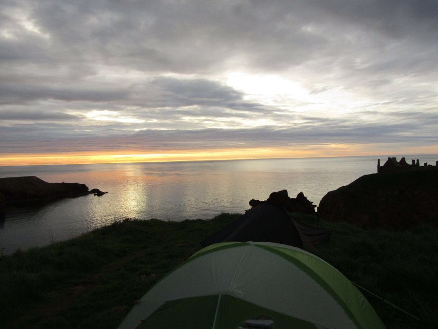
My loud beeping wristwatch disturbed me from my slumber at 5am, and I realised I hardly felt rested at all. For a moment, I contemplated a few extra minutes in bed, but I had set it for a reason – I wanted the sunrise photos, and after walking this far those few extra minutes could wait, especially as the rather grim evening weather had shifted completely and we were now blessed with a beautiful morning. Wandering around taking photos took a few moments and I lay back in the tent to enjoy the morning light. I must have dozed off for a good while (probably the red wine) and remember waking to dogs barking nearly three hours later. Sitting on the grass enjoying the still morning followed, and I finished breakfast in full view of the morning walkers, with us packing up to leave not long after. Just in time to avoid a coach load of French tourists, who had appeared for their trip around the castle.
One of my favourite shots of the trip. Gabe and I perched high on the cliff, gorgeous sunrise behind, the castle in the background as the water shimmered gloriously.
The ritual of all crossings had to come next: something we had put-off last night due to, frankly, being absolutely knackered and not feeling like an extra eighty steps in the rain. We descended the castle steps now, though, down to the rocky beach – taking a moment to relish the experience – and then dipped our toes in the sea. I didn’t suddenly feel a zen-like sense of relaxation and completion …. probably as the rocks were bloody slippy and I was concentrating on not falling over – but it was the point where we felt we had ‘finished’ properly.
Back to Stonehaven
The path back to Stonehaven past the French tourists (who inconveniently blocked the path) was a total contrast to the same path in the wind and rain of last night. Yesterday it was all about grit, endurance, ignoring the weather as we arrived after another mammoth day – but today it was about relishing that sense of completion. We gazed out to sea, watched a lifeboat crew practice manoeuvres in their RIB, and greeted every passing morning runner with a genuine “good morning!”. We were, in short, sickeningly cheerful.
By the time we arrived in Stonehaven centre the town was just starting to come alive as the morning shoppers turned up. For a moment we considered staying a little, going to the harbour, but we picked up some supplies and took the next bus to Montrose, with both of us keen on not hanging around and eager to dump our backpacks in the hotel. The coastal route was gorgeous on such a clear day and the top deck was a pleasant experience as we zipped our way through little coastal villages on the forty minute drive to Montrose.
Upon arrival, checking-in came next, obviously we both wanted a shower more than anything, but we had also sent boxes of clean clothes (as in properly clean, not just rinsed in a stream or loch and hung to dry from your backpack for a few hours). Checking in wasn’t a problem, the manager had the boxes to-hand as well. We immediately got a brw on, took the backpack off and enjoyed the stillness. We were somehow given a room with four single beds, so we had absolutely acres of room to spread out – not to mention the extra two packets of shortbread next to the kettle (small victories..)
Our cliff perch in the full light of the morning
Southern side of the bay
Time to descend the steps and dip our feet in the sea..
Showering and finally getting a clean shirt on we decided to amble through Montrose. There was a music festival on that weekend and the stage was already assembled, something which contributed to its’ ‘seaside town’ credentials. There were some pleasant areas by the promenade already hosting a few car-bound holidaymakers enjoying a few rays. Considering the dinner at the Park Hotel was a good six hours away, we had decided to leave our packs and head to the beach. If I had to pick one thing Montrose can be famed for, it would definitely be it having a remarkably nice beach – with soft sand, few rocky areas and a lovely beach-front to whittle away hours at, whether you’re a runner or a family looking for a spot to take the kids. As it was now around noon it was bathed in sunlight and gave us a great place to spend time working on our tan (mostly on one side of our face due to walking west to east) and ambling barefoot along the shore. We spent several hours doing exactly that, winding down from the 50km+ yesterday, before finally leaving and heading for lunch in the centre and eventually ended up at the Park Hotel, the gathering point for the Challengers. On our way back we found the camp site, already full of Challengers with a forest of tents, some we recognized and some entirely new, before turning the corner and finding the Park Hotel itself.
Montrose beach. Almost to ourselves.
Lifeboat exercises. This was shot at 40x zoom with them quite far out at sea, we weren’t rowing in a boat alongside them 🙂
Walking in, we had a distinct feeling we were a bit early, though there were some already starting on the beers (technically it was afternoon, but still). We decided to come back later and relax at our hotel for a while, take another shower (the sun tan lotion needed on the beach sorta made it a neccessity) and chill out. A few hours later we were back at the Park Hotel, collecting our hard-won certificate and recognising faces from Tarfside, Braemar and even as far back as Dornie. We joined a group for drinks, with some members of the group already having spent the entire afternoon in the bar by the looks of it, being in that they were walking precariously and seemed pretty sloshed! The evening dinner came next, an opportunity to meet loads of new people and catch up with those we had already met. It’s worth mentioning a good portion of the Wednesday finishing ‘group’ were Americans, who were all interesting, friendly people, some who had fantastic stories to tell of their experiences back home and in other parts of the world. During the dinner, we found there were a smattering of people completing or heading towards the ’10 crossings’ mark, which is an impressive feat to get to – and we made our introductions to congratulate them on being stalwarts and sticking with it.
Time for a pint. Once we step over all the backpacks strewn everywhere.
Everyone shares their experiences at the Park and when asked, we recounted our trip to various people and were met with wide eyes each time – even for multiple-time veterans of Scotland we felt they knew we were pushing pretty hard. But when you talk about distance walked, hours on your feet or anything else you are only getting part of the experience. For fun on the train back (it is a long way, don’t judge!), we did some googling and worked out we did around 1,200,000 steps between us on our trip, along with using over 100,000 kcals – that’s the same amount as is contained in 500 pints of beer, or seven Big Mac meals for every day of our challenge.
But those stats, albeit impressive, don’t describe in any way how some days it simply hurt for every single one of those steps, or how many times we needed to dig deep again and again to keep trucking along. Coming in to this, the distance, the vertical ascent were all impressive ‘markers’ we could use to try and quantify our Challenge, but at the end, it was all about personal traits, how you cope with unexpected adversity and find out whether you have that determination within and how far you can push that.
Part of the reason I wrote this in a ‘diary’ style was to try to include and remember those little details I expected to forget with time – and wanted to emphasize that even despite those painful, difficult experiences, despite the upsets, despite all that… how it was a superb experience. Hopefully, reading this, after getting to this post (and enduring my irregular posting) you get a window in to our psyches and how determined we were to finish this in the spirit we had planned it, to push ourselves whilst eeking-out as much as we could from the experience in every way possible. Alternatively, you could say we were a bit mad, and both answers are probably correct to some extent.
Stonehaven harbour
Most Challengers do it once, we were told during our crossing – and those who manage 5, 10 or even upwards of 20 are very few – being as they are afflicted with either chronic forgetfulness or great determination indeed. ‘Multiple Challenger’ was never a label we expected to ever want when we started this, even though through reading others’ blog posts and talking to people who completed many, this was a fellowship they clearly cherished, with many genuine friends made over the year.
For us, we thought it would be a one-time deal. We realised during the crossing that the excitement felt when cresting one peak and seeing a whole other host of mountains and a glen lit in full sunshine on the other side was different than a long weekend trip – how day after day of this doesn’t dull the curiosity within for wild spaces, in fact, it does the opposite. It puts you in to a state of mind where you are receptive to the beauty of those spaces and feel privileged to be able to enjoy them, and at double the previous length of my longest self-supported backpacking trip this was an acute feeling.
Even when planning the route last year we felt the sense of possibility with wild places at every turn, and listening to other Challengers talking with enthusiasm about beautiful mountains and quiet fells was deeply infectious, and in many ways served as inspiration for the future. Anyone who has sat down and looked at topo maps has likely had the same feeling, of tracing the contours with your fingertip and letting your mind build a picture of the terrain – coming away with a firm desire to see it with your own two eyes.
The Challenge is a superb tool to deal with this addiction to new wild places – a yearly vehicle to almost siphon that addiction out in two-weeks of concentrated hiking every May in a beautiful part of the world; yet behind the activity itself exists the strong social links between people who often started their friendships in the middle of a mountain range somewhere, casting eyes on each other and egging each other on; that social side which shouldn’t be undervalued, as hiking often can be a pretty solitary hobby.
Local cuisine. I include this as Gabe mentioned repeatedly that he wanted a deep fried mars bar at Stonehaven during our crossing (despite me warding him off), and by the time we got here it was shut.
It could easily take two dozen Challenges to explore the places we want to see within Scotland’s wilds, but by that point, I’m convinced it’s the people you stay for. It’s the mad bastards who amble across mountaintops cheerfully in the middle of a storm, rain running down their face, yet who put their thumbs up when you ask how they are doing. Those who cheer you up when you meet despite them knowing you’re in a bad way, or the friendly waves of those camped on some quiet mountain-side as you catch sight of each other from a couple of kilometres away. There is something fantastic about that, you know some of them are suffering, their feet slowly falling apart or their route not going as they had wanted, but you cheer them up and they do the same for you. It lets you see the best of people when they are tired, often grumpy and in pain, yet still make an effort.
As for one of the big questions, will Gabe and I be coming back to do another Challenge? Like anything, it isn’t that simple. Gabe seems quite convinced he won’t be doing another Challenge, yet I am ‘cautiously’ convinced I will do – the caveat being that I don’t know when. I’m considering the 40th Challenge in 2020, but the ‘where’ needs a bit more fleshing out. What we can say for certain is we both left Scotland having adored the wild areas, somewhere we haven’t been on more than a half-dozen trips (although Gabe does tend to like getting the crampons and ice axes out to enjoy the Scottish winter). We both would love to see more of Glen Affric especially, with our intention to head there for a few days with a static camp to do a few Munros, as well as doing the Cuillin ridge traverse at some point over the next year.
But another Challenge presents us with the elephant in the room, which is the last three days of the Challenge (Glen Dye aside) just weren’t that interesting, and many areas suffer from being full of wind-farms. Wind farms themselves are not especially bad, they are visually disruptive, sure; but the hidden issue are the kilometres long haulage tracks and the land they have to destroy to gain access to these wild areas, which cover vast areas. The number of options to plan a Challenge route whilst avoiding the myriad of wind-farms across Scotland is certainly dwindling, with hydro schemes (and their resulting construction areas) limiting those futher.
To illustrate this, one of our favourite days spent at Charr Bothy and Glen Dye, a surprising gem on our trip with plenty of wildlife and gorgeous green hills, is facing the prospect of becoming home to an initial half dozen wind turbines. As is the land just over the fells we walked over from Tarfside, which already have their heavy machinery access paths built. There is no silver bullet to stop these developments, and many far more talented bloggers and activists are highlighting how to help preserve the countryside – but from the point of view of a potential Challenger it is important to be aware of this.
The west coast seems, at least at current, more resilient to these sorts of developments, and were we planning another route I’d want to explore the most there first and foremost. This doesn’t outweigh the many beautiful places to roam to the east of course, and I’d encourage anyone to sign up to cross Scotland if they feel an urge to do it, but just be aware your trip will be much the better if you spend some time and effort trying to pick your way through these areas. Sometimes it may be necessary to eschewing the path of least resistance for a diversion through a beautiful glen, or a slightly out-of-the-way summit in order to get the most out of your trip.
It’s worth mentioning that during our trip we were raising funds for our Mountain Rescue team (MR), with our final tally at the point of writing over £1,200 raised, with ‘offline’ donations a huge proportion of that. If anyone is still interested in contributing to our cause, please spend five minutes checking our donation page out, which will continue to run and is open for anyone who wants to contribute. Despite it being a fair amount of time from May, there are still donations coming in, and any and all contributions are welcome, even the equivalent of a cup of coffee. Even if you are not able to donate, we have included a little info on what it is MR teams do, how they are funded and there are some pictures of our MR team training and on call-out, so if you are interested, have a read.
Thank you for reading, I’ve thoroughly enjoyed writing it. It was hard not to grin whilst writing some of the days, from the absurdity of Gabe’s pulled calf muscle on the first morning, to flu, injury, friends made, painful feet, beautiful fells, massive days, 22-hours of non-stop hiking, too much porridge, an almost missed resupply box, four days of limping …. everything, really. I’ll leave you with a sequence of pictures from the Wednesday before we left Scotland as we ambled along the beach barefoot, laid on the sand and soaked up the sun – feeling we had given ourselves a Challenge to remember.
Balancing on the seaweed. Finally both of us in a single shot. Dunnottar Castle, TGOC 2017 complete.
Every film series has that inevitable part which gets – for want of a better phrase, A Bit Rubbish. It’s inevitable, really, you just can’t keep up that non-stop action without the plot not making sense, and you end up watching the glittering, stupendously expensive CGI effects and not caring one jot about the protagonists. This is the movies, see, and the good guys have to win – even if it ends up as a horrific convoluted mess in the process. For every The Matrix there is a head-scratchingly-odd Matrix Revolutions; for every Terminator, there will forever be the mash-up mess of Terminator: Genesys sharing the moniker. Gabe and I had already got our rather crap sequel out-of-the-way, and were now stocking up on the popcorn for a Return-of-The-King-level finale to our crossing. It was time to dim the lights and get stuck in to finish it how we intended to in the very beginning…
Blazing sunshine greeted us that morning
In yet another change to our original itinerary, today was not actually intended as our last day. ‘Cheyene Hill’ (835874 for those with a map handy) was about the only little hill on the map which could make a scenic campsite with a coastal view, and if the weather kept kind we were aiming to get there by the evening after a day of forest walking, ending in us enjoying the sunset with spectacular views of the sea – before ambling in to Stonehaven the morning after, with barely 6km left from our proposed camp. That was the plan, anyway, and our plans have proved pretty flexible this trip.
Charr Bothy was a fine place to start the day. Waking early and looking outside, a clear blue sky was tempting us to make good time and hit the coast later in the day. Breakfast in the sunshine followed, with us anticipating a pretty easy day of walking through the forest in the sunshine. We restocked all our water to maximum, aware we were entering farming land and would need it if it turned in to a scorching day, signed the visitor’s book and headed off. A couple of leisurely hours of strolling down a track until we reached a bridge to take us across the Water of Dye, allowing us entry to the Fetteresso, a 20km-wide forest, as the countryside changed from barren hills to woodland.
Not a bad start to the day
The Fetteresso itself began with much promise, with us winding along the deserted Old Military Road and cutting in to the forest on a logging track. The outskirts were certainly beautiful, with it warm enough to need sun-lotion, but this gradually changed from untouched forest to include a smattering of abandoned heavy machinery, oil drums and a general sense of lots of work having been done to the place. There were signs warning not to drink the water (something we were aware of) and even though we had stocked up, we knew it was unlikely to last us all day, especially in the heat, with our filters little help due to being designed for removing micro-organisms, not chemicals.
Entry in to the Fetteresso forest
Gabe’s too quick for photos
As we meandered through the forest in the blazing sunshine, covered in suntan cream, we were trying to get a bead on the place. Many Challengers have said they loved it, yet some absolutely hated the place, calling it sullied and a sad reminder of the work eking away Scotland’s wild spaces. The wonderfully little green access pathways seemed glorious and the machinery wasn’t that excessive -surely they must have just been there on a particularly dreary day?
We continued until we excited the woods, emerging into the wind-farm proper, or at least the edge of it since it’s a colossal site, with an estimated 40 units whirling away across the best part of 4km. The lush forest’s deciduous shrubs and trees simply disappeared, changed instead to a barren open area with drainage channels, compacted access tracks and debris strewn all over the place. It’s an absolute mess, frankly, and a couple of hours walking through the wind-farm was more than enough for us. We were approaching mid-afternoon by this point, and we had plenty of forest to walk through on winding tracks before our camp.
Laying down on the job
Gabe and I were to have other ideas, however, as we didn’t feel there was enough untainted water in the forest on a piping hot day to make a forest camp feasible. We were expecting to walk miles of compacted tracks, too, and felt rather than getting ourselves in a situation of camping later with no water, we’d make a push for the coast today and make it all the way. We headed to the south-east of the wind farm, past a whole host of additional machinery, generators and metal fences – then decided we’d pick the most direct route, head over Leachie Hill (a 400m trig point) and pass through farming land to the quiet B-road. This did involved jumping over a double barbed wire fence (when does it not?), but we were convinced it was the right choice, and our hiking gear survived intact, despite a precarious wobble at one point and a bit of swearing. Level land, faster route and guaranteed water provided we made it to Stonehaven seemed quite obvious pros, despite the fact it was road walking a rather major negative. The feet weren’t that bad after our half day yesterday and diligent treatment, but we were certain what 15km of road walking would do to them.
Our first view of the sea. Including wind farm blade and debris strewn path for extra flavour.
More sea! We are close now, surely? (this was taken with 40x zoom)
We decided Stonehaven was worth pushing to tonight, despite it approaching late afternoon, and cracked on with us expected to arrive in Stonehaven by 9pm. A camp on the way would have been a solid backup plan, but most of these fields contained beasts and it wasn’t worth risking and agreed we’d find a wood if we had to. There is little worth writing about road walking, and we spent the afternoon going through periods of downpours intermingled with blazing sun. After a few stops to take the waterproof on and off again, I decided to just keep wearing my merino base layer and get soaked during the next one and live with it, as my grandmother would have said, ‘skin’s waterproof anyway lad’. We probably spent four hours to reach the outskirts of Stonehaven itself and were going a fair pace. Even so, it seemed quite a long walk to the coast at the time, but by this point we knew we had made it – despite the feet screaming for a respite, our only question was where we camped for the evening and when.
Meeting the locals
Stonehaven began with an industrial estate and few shops open on the way in due to it getting pretty late. A fuel station seemed to be the best bet, and so we ended up doing a surreal supermarket sweep, with some easy food for dinner, a celebratory bottle of wine, and something for breakfast the next morning. I was struggling with the feet/leg at this point and so sat outside, causing a few drivers to cautiously do a double-take to be sure we weren’t planning on robbing them as they went back to their cars from paying for fuel. Backpacks were loaded and our spirits definitely improved after a proper stop, before we cracked on to the coast with the intention of getting our feet in the sea.
‘Forecasting stone’. Who needs the Met Office anyway..
Stonehaven isn’t the best place for ‘easy access’ to the water, however, and we ended up walking in the rain as dusk approached, taking the coastal path to Dunnottar Castle, our stated ‘end-point’. There were a few evening runners about and the odd couple having a leisurely walk with their waterproofs on, but we were determined to make it, still in the base layer with water running down our faces. The feet were burning from so much walking on hard tracks and roads (about 38km today), we were likely a little sunburned, but this close to the finish we were prepared to set up in the dark if necessary.
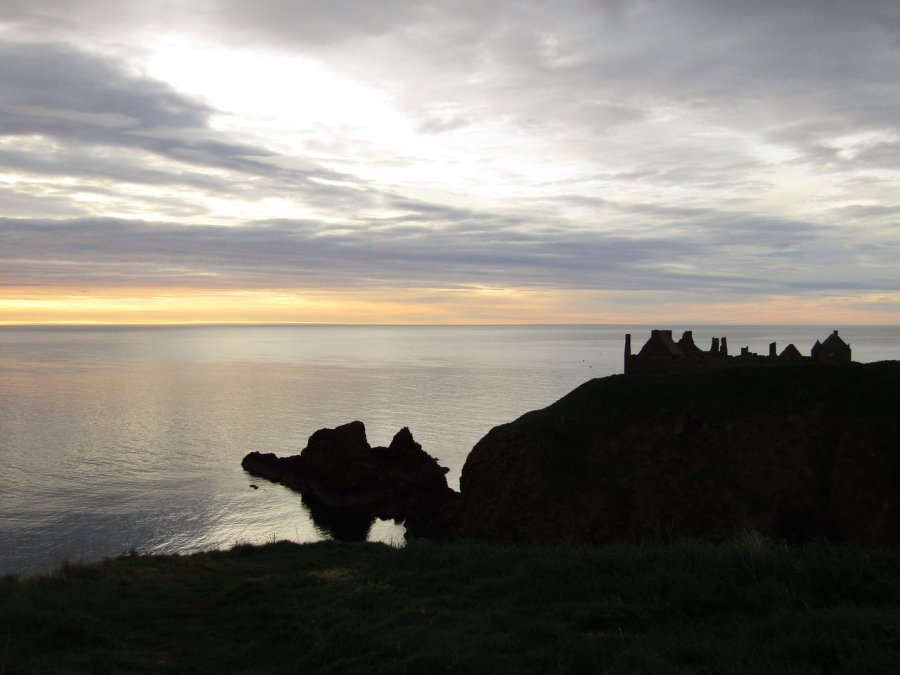
Arriving at Dunnottar Castle itself, a cliff camp seemed a good shout despite the chance of strong coastal winds during the night. Camping on the beach or further back would have worked, but we really wanted to A) camp right now without moving any more and B) a good vantage for sunset and sunrise the next morning. Camp was made rapidly with all the guylines setup in prep for a rough night and food soon followed, made separately in our tents as it was raining pretty heavily.
Zoomed shot across Stonehaven centre. Last shot before it started lashing down.
Afterwards, we shouted to each other to get the jackets on and both sat on a grassy knoll facing the castle and the water. It was quite an emotional moment in many ways. Perhaps it is that I figured I’d be unable to continue sometime during the next five days after injury, or perhaps that it necessitated being so focused on the moment, on the next goal, that I was caught out by that feeling when I realised we had nowhere left to walk tomorrow. Sitting down, sharing some food, we felt the wind blowing in our faces as the rain started to intensify. We sat there with our waterproofs on, hoods up, drinking red wine and grinning. We had done it.
The rest of the evening was fairly short due to arriving so late, having walked for probably 12 hours that day. The bottle of wine was finished pretty quickly, enjoyed what was left of the sunset (although it was an overcast evening and there wasn’t much of one). Retiring to the tent, I checked the guylines were prepped for a heavy night and set an alarm for 5am. We were damned well getting up for sunrise no matter how tired we felt right now.
We woke to sunshine and a clear blue sky, a welcome contrast to the overcast damp afternoon which robbed us from the views during the previous two days, and during our traipse over Mt Keen. I woke especially early and spent a good hour reading, enjoying the lack of movement of my limbs with the leg seemingly behaving today. As the early morning went on the forest of tents occupying Tarfside began to stir, the early starters making breakfast as I lay there with the flysheet open, contemplating something one of the other Challengers had said yesterday: “You’ve done it now, just need to get the east coast without any drama, congratulations”. Well, we had certainly had our drama up-front for this trip, but the advice still remained true and I was conscious of taking it relatively easy.
Day 11 – the original route. You can see our diversion over Stobie Hillock to the south
Facing the coast – more people packing up
With that in mind, today would put that advice in to practice, and we set off for a relatively leisurely day over the tops and in to an adjacent glen – with the intention of getting to Charr Bothy and deciding whether we had the inclination to keep pushing on to the Fetteresso forest to the east. This was a fairly leisurely 16km, and with all day to do it, we felt we could amble as much as we wished.
Towards the Hill of Wirren
Our original route plan was to head north from Tarfside and curve around towards Craig Soales in order to tackle Mount Battock and a succession of six hills – something we had been told was extremely rough ground, but has since been turned in to an access track by the landowner. We considered this, the views tempting us, but ultimately the uncertainty of exactly what they had turned in to road and the need to hike around 18km over unknown ground and six hills to complete this made us opt for the much easier option.
Facing South from Tarfside – The eagle eyed may see a well hidden house in the middle of the copse.
After a leisurely breakfast, we wished as we could find a good trip and set off. We expected to not see many of these people again, and it surprised me how genuinely I wished them well, people who were strangers barely two days ago. Some of the crowd had left early, mentioning wanting to head straight to Montrose and presumably wanting long days of river walking to make a good time, but we still felt there was enough in the tank to enjoy the rolling hills and the Fetteresso forest the day after.
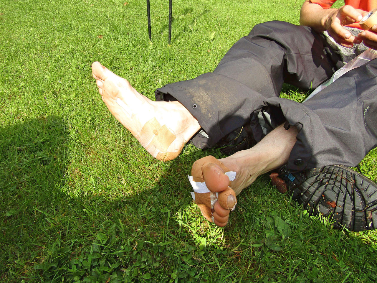
Gabe’s feet. I realise we have yet to have a Gabe’s ‘foot shot’ yet, but safe to say he was in need of patching up.
Heading east to Blackcraigs and Milden Lodge made for a gentle start with the rolling hills providing us with leisurely walking as we made use of the easy contours. Milden Lodge seemed to be a gathering point for a hiking group who had appeared for the day and we sauntered past as they were getting their boots on, in a fine mood with the blazing sun on our backs and the knowledge of not many miles to go.
Fine views – but the winding path up the fells we can do without.
A sturdy, recently made track headed to the north-east up the fell and we were struck by the familiarity with the Monadhliath commercial paths. These were less large but compacted in the same way, and made for a speedy couple of kilometres gaining height. The views were Not At All Bad and we were admiring it as a hiker stormed past us with barely breath to spare to say “hi!”. This proved a pretty lovely spot, with a fine view to the west of the hills, yet we were both discouraged by the huge bloody road going up the hillside, and two more huge lines reaching their way up adjacent hills. Yes, it made life significantly easier, but like our experience in the Monadhliath, they detracted from the wildness of the place.
Hiking hard
Fortanately, the ‘road’ came to an end and we set off over rough ground to take us over the saddle, between Stobie Hillock and Hill of Saughs. Cloud and a little rain ended up drawing in and this proved one of those situations where the ground was not ‘as advertised’ on the 50k, but we made adjustments, ended up jumping over a fence, descending the gully to the north side and joining a rather worn track to take us to Charr through Glen Dye, once again basking in sunshine.
Bridge having seen better days
When originally planning the route this little section was almost an afterthought, yet we spent a few glorious hours ambling along the track enjoying the countryside, the sound of trickling burns accompanying our progress to Charr Bothy. Strangely, this was the first bothy stop of our trip, strange because when we planned our route we aimed to use bothy stops almost entirely, eventually ditching the idea in favour of more remote wild camps.
Charr Bothy
Arriving at Charr, having heard some bothy horror stories in the past, we were pleased to see it functional, clean and cosy – in addition to seeming pretty draught-proof with double entrance doors. We got settled, intending to stop for a late lunch, rest a little and make a few hours progress in to the forest.
Gabe checking the food whilst we get the map out to find the best way through the woods
Firing up the stoves, we swapped lunches for variety and ended up pulling the chairs outside to enjoy the fine weather. Whilst waiting for it to hydrate properly, the landowner pulled up to grab some materials from the restricted, ‘estate owned’ part of the building and we got talking about our trip. He seemed interested and wished us well, driving off as we were left to our own devices and our warm lunch. I pulled the map out, and pondered the best way to use our next two days. Did we really need to continue tonight? By 4pm the decision was made to stay – and we looked forward to a leisurely evening and a night on a raised bed, with proper walls.
Ah this is the life. Beautiful weather, good company and hot food.
At this point the landowner returned, stopped and greeted us, generously handing us £40 to add to our charity fund and regaling us with a story of him trapped up a mountain. Apparently he was hypothermic after having a severe fall, and would have likely not been here today were it not for the local Mountain Rescue team, so he obviously had a personal affinity with our cause. We bid him farewell and had several hours of enjoying the afternoon with precisely nothing to do; we had no phone signal, so it was purely the outdoors and us. Towards early evening the weather started to turn, with the clear day turning in to rain and high winds – we were pretty pleased to be out of it and snug inside.
View to the south of Charr
We lit the bothy candle, cooked dinner, and just relaxed. Unlike the previous evening there was no arriving late somewhere, it was wonderfully relaxing and felt like turning down our whirlwind trip to a gentle pace as we savoured the experience, the feeling of being in the middle of nature as we heard owls hooting outside. It rapidly started to cool as it approached evening and we decided on an early night, both in the main room as the side ‘bedrooms’ were much colder. We did notice a note on the visitor’s book from an American Challenger we met the night before, and added our own entry. Overall well worth a stop, and we looked forward to tomorrow’s trip through the forest as we drifted off, storm battering the bothy with rain lashing against the windows.
Waking early, I crawled out of the tent and made an urgent beeline for the facilities, after the previous night’s beers – it was probably the fastest I’d moved for a few days. The night had been blustery and wet but the well-protected campsite allowed us wake rested. Gabe seemed to be stirring early today and a trip to Gordon’s Tearooms beckoned, the mercurial little place which opens especially early during the Challenge and was rumoured to do good breakfasts. With a kick-start needed, we left the tents and headed off.
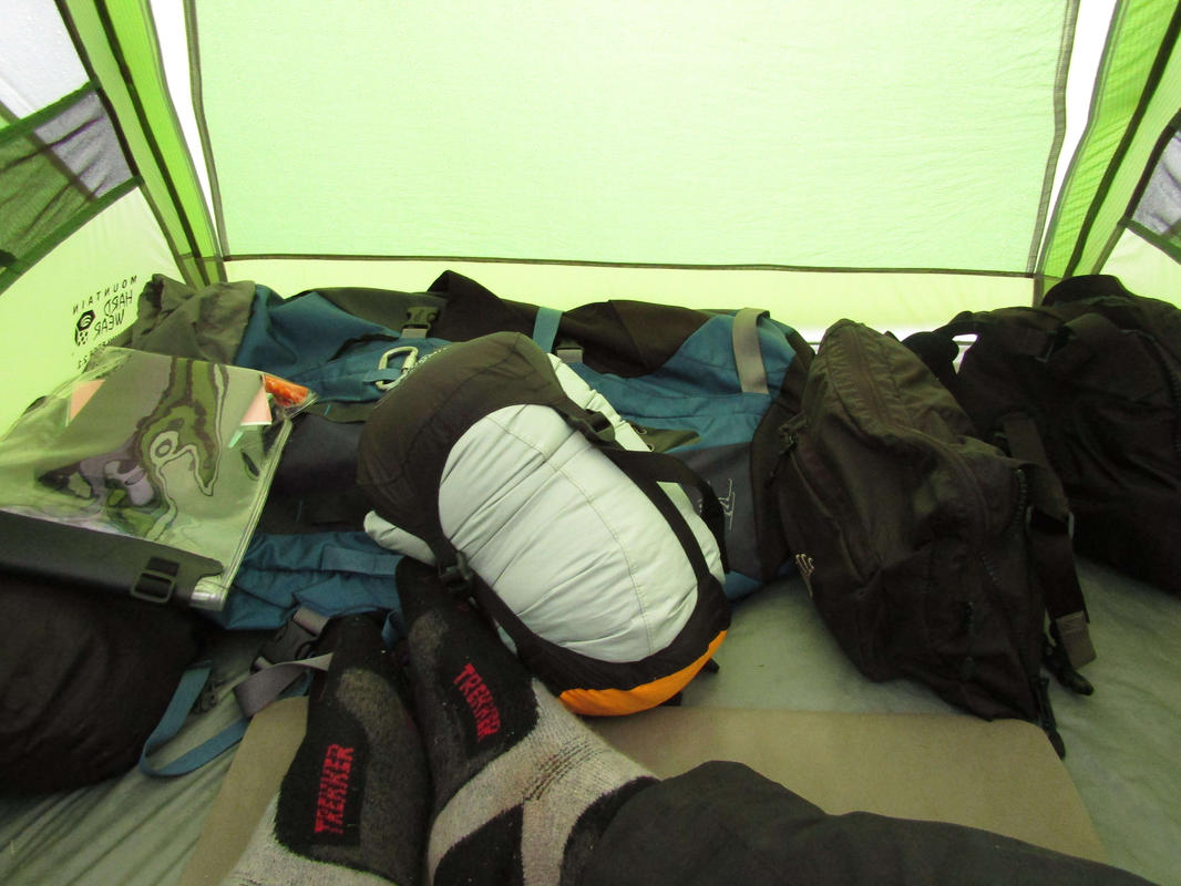
The morning pile of kit
Braemar was enjoying a sleepy Sunday morning with nobody about, the breeze gently blowing our faces as we saw hints of the morning sun coming out. Arriving at Gordon’s, there were already had a few early starters occupying tables, including a chap from Minnesota I had met the day before who taught bushcraft for a living. The others were a mystery despite being clad in outdoors-gear, I know there is a bunk house in Braemar so perhaps they were from there.
Gabe eating chips for breakfast. The uncultured swine.
Two proper Scottish breakfasts were ordered and the coffee was a god-send. I had pocketed the new map from yesterday and pulled it out to trace some routes, with us now fresh it seemed a better time to judge what I could manage. Gabe, usually a vegeterian-of-convenience, went off the deep end and ordered a bowl of chips alongside his full breakfast; confused, the waitress asked whether he was sure, leaving me to explain he is foreign, and thus unused to civilized breakfasts. Tucking in, we joked a little and greeted the procession of Challengers entering the place like a reverse-clown-car, until almost every seat was taken – presumably roused from their slumber by the smell of crispy bacon wafting across to the campsite.
Everyone seemed in the mood for a leisurely breakfast, it seemed as if we had decided, en-masse, that we weren’t actually that bothered about finishing the Challenge and instead felt like a time-out. A second coffee was poured as we greeted the arriving French contingent, who we first saw at Drumnadroicht pier, seemingly all in fine form yet looking sleepy. Our route had been roughly fleshed out yesterday, but we had agreed to call it provisional in lieu of me feeling useless this morning. As it happened the swelling had reduced a fair bit, and whilst nowhere near back to normal, I felt I could manage the day, which was just as well as it would turn out to be an absolute bastard.
Leaving Gordon’s Tearoom we ambled back to the campsite where we packed up and wished everyone well, it now looking a thoroughly overcast day. I handed Mike my spare beer as I didn’t feel like carrying it, and we set off. This would be the last time I’d see Mike during the Challenge, as he was running a day ahead of his schedule and intended to stay around Braemar for the day, in order that he might finish on the Thursday. Ballater had been mentioned before in our conversation together at Dornie back when we intended to be nowhere near the place. Now, it was going to be central to getting back on track.
I didn’t think I could afford walking a scenic route consisting of back roads and little woodland ascents, instead I wanted to make as much distance as possible; and so we began the most boring and bloody painful day. I won’t bore anyone reading this with a full account, I’ll keep it mercifully short. Suffice to say we walked 32km on the road to Ballater, mostly in the rain, which took us a good 10 hours of walking – I simply was not able to push any faster.
Answers on a post-card. I believe this may be Altdourie?
The rain was a blessing in some ways, we were glad not to have bothered with Lochnagar as seeing anything would have been nigh on impossible, which made losing one of our hill days less of a blow. There were hundreds if not thousands of cars which passed us during the day, and I’ll freely admit that by the 25th kilometre I was seriously considering bumming a lift; but we persisted. Arriving in the town as the daylight started to drop, the feet were aching like a bastard from the hard road surface with much of the previous few days of careful recovery/use undone. The slow lengthy downhill section felt a long way as we finally arrived in the centre.
We discussed earlier in the day that we’d camp as far to the south of Braemar as possible, and failing that at the campsite, purely so we could get an easy and quick pitch with a minimum of hassle. Looking at the map that morning there wasn’t much to be said for simply heading east with miles of road walking ahead – even despite injury we felt this would be beyond what we were willing to endure to finish. Instead, we wanted to link up with Tarfside by tomorrow night using the Glen Mark route. This would let us walk on softer ground in addition to staying in roughly the ‘pocket’ of being able to enter the Fetteresso Forest, with the added bonus of having an opportunity to drop in to Tarfside and enjoy the hospitality.
By this point it was around 8pm, later than we would have liked, but early enough for places still to be open. We stopped for dinner, our first stop for more than ten minutes all day, and it was almost a strange experience to be still. I was in quite a bit of pain by this point and didn’t think I could do the extra 3km to a forward wild camp for tomorrow. Wandering around Ballater, completely by chance we found Habitat, which has since changed its name to Ballater Hostel. The opportunity to rest in a proper bed was overwhelming and barely ten minutes later we had our packs on the floor in one of the hostel’s rooms, enjoyed a proper shower and met (yet another) motley crew of hikers.
After repairing the feet and getting the socks back on, I went to the lounge area where some sort of local hiking coach-tour was congregated. Many of them were leaving on a hike tomorrow, with a few routes offered, but the net result was a very full hostel. You might think we wanted a quiet evening, but this bustle was pleasant, with the snug lounge area filled with people discussing their latest hiking projects and eating food picked up from the local Chinese takeaway. Gabe decided to have a nap whilst I hobbled about socialising. This was the point where, lo-and-behold, Peter the German arrived (!), the guy we seemed to run in to wherever we went, culminating in him giving me some of his food as we talked about the past few days and how he was enjoying life in the Scotland.
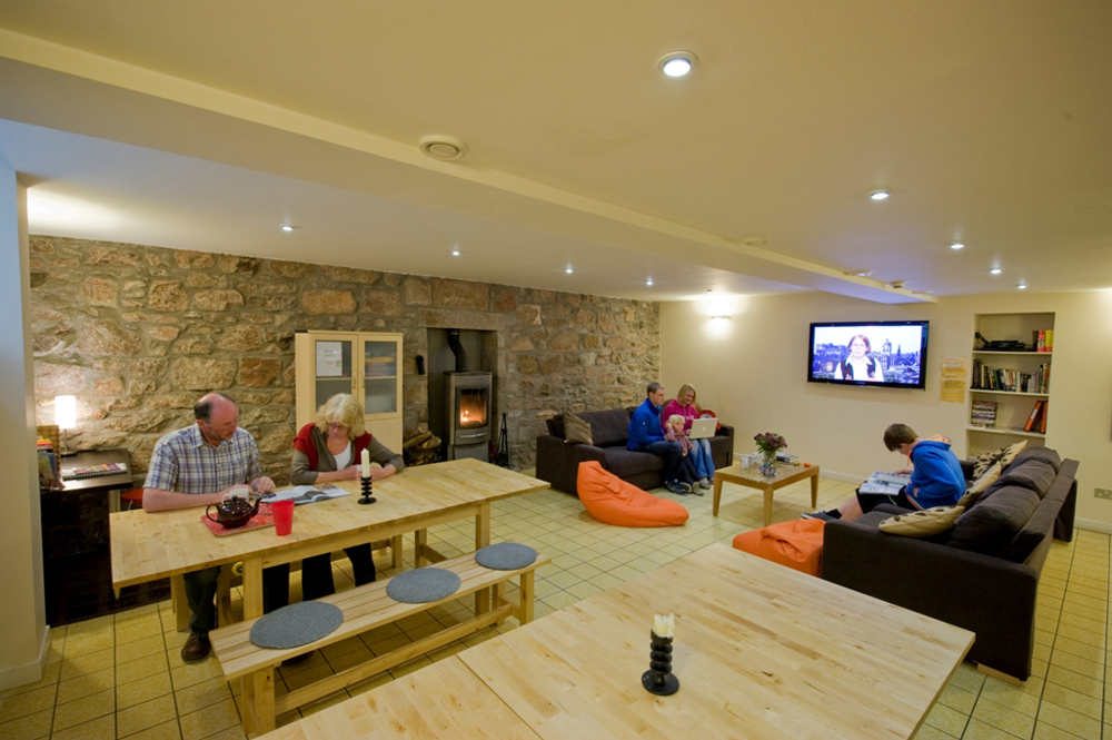
Stock Photo of the hostel
The owners are a couple, Dominique and Dan (an ex army guy), and were good company after what was a pretty boring day of road walking. There were plenty of jokes going around and clearly had strong knowledge of the area, even though they had only taken the hostel over in August 2016. They were glad to see such a busy hostel, they had had a difficult winter due to the lack of snow in the area not attracting the usual winter aficionados.
Clean bedclothes, a proper shower and the drying room were all fantastic, and after greeting the other Challengers in the hostel we crashed for the night with an early start needed tomorrow.
Day 10 : Ballater to Tarfside (26km)
Our original planned route, coming in from Lochnagar to the west
I sleepily heard the electronic beep of my alarm, rolled over and nearly fell out of the bed. I had ended up with the top bunk, so this wouldn’t have been a good start to my morning.
We quickly got ready, there wasn’t much interest in wandering around Ballater for breakfast, instead we found some rice crispies and bread surplus to requirements, which were quickly reappropriated along with some marmalade.
Early morning hostel bunks
Today’s route involved a slow walk to the south of Ballater and overall would be a test of my fitness, with a fair bit of moving over rough ground. We slowly crossed the bridge in the morning sun, taking the B976 south for a mile until we hit our turn for Glenmuick House, which appears to be a private house. We took note of the Private notices and decided they wouldn’t be too bothered about two backpackers walking through at 9am, continuing through in order to gain access to the track behind the estate which headed up the hillside to the south-east.
Day 9 – part 1
We were slowly making our way towards Mount Keen, itself a Munro, something we had expected to have seen the last of on our Challenge. Looking at the topo maps, we wanted as much time on proper tracks as we could to minimize heather-hopping, and this route would let us cut back down to an easy glen whilst forcing us to gain a little height to do so.
Moody sky
Continuing uphill we passed a couple of trail runners putting in the early morning miles, both of them looking a great deal fresher than we were, but we were making distance slowly and surely all the same The gentle slope becoming steeper as we rounded Craig Vallich – with the view superb, despite the cloud looking turbulent. The path was a compacted earth path, considerably easier to walk than the ones covered in rocks that we experienced during the early days of our Challenge in the west.
Gotta keep up with your social media
The signage is actually surprisingly good in this area to the point where only the poorest navigators can expect to get lost, with Mount Keen actually signposted a good half dozen times(!), though there are still multiple ways to get there. We had decided on the path which struck out to the south-east over Lach na Gualainn, which provided to be little more than a sheep track through the heather. There was little choice in the matter, so off we went.
Moody shot of Lochnagar to the west
The track ambled indirectly towards the Water of Tanar, and on the way it seemed that everyone was on their holidays nearby. We had mountain bikers pass us, a few hikers, and one Challenger kept appearing in the distance, his white backpack acting like a beacon as we repeatedly closed the distance on each other before our alternate breaks widened the gap again. Approaching the bridge over the river, we took a look down in to the valley and wondered what was going on. Otherwise in the middle of nowhere, a line of mountain bikes had been left whilst their owners presumably climbed Mt Keen, with hikers converging from every angle. It was beginning to take a turn for the worse weather-wise, with dark clouds starting to move from the horizon and approach. Undeterred, with half of it now done, we started with the ascent up Mt Keen on the Mounth Road.
In case of being navigationally challenged
Lets just say I didn’t appreciate the several hundred tonnes of rock they must have used to build the path, with it starting with a steep section of loose stone which often slipped beneath our feet. With the weather worsening we threw the waterproofs on and cracked on, with the steeper section evening out to a gradual ascent where we could use the earth to push ourselves up instead. I had been looking forward to putting in the last push to summit Keen for a decent view, but by the time we were 700m up it was clear it was not to be, with the peak clad in low cloud with rain pouring down, making it effectively pointless to do so – just as well, as I was struggling with the leg. Gabe seemed to realise this, reassuring me we had done the hard bit, with us now slowly descending in to the next glen.
Riverside
What followed was several miles of loose-rock descending, which was agony, plain and simple. I groaned under my breath like a wounded animal as I descended the steep area of Couternach as we approached the Ladder Burn, it was really starting to give me a lot of grief, and I was questioning the wisdom of ‘just heading over the top’, even though we had specifically pinpointed this area as a potential problem from our topo map earlier.
Somewhere near the Queen’s Well
It was at this point we were greeted by about 12 girls returning from Mt Keen, most of them without anything more than a light daypack, minimal waterproofs and perhaps a bit of food. Obviously I perked up a bit. We were caught relatively quickly during this difficult section, ending up chatting as we approached Glenmark and the Queen’s Well.
It turns out they were researchers from Aberdeen from a NFP on a team building exercise, with some optimistic soul having suggested Mt Keen as something worth doing. Talking with the senior researcher/analyst, Rachel, who seemed to be chaperoning the rest – it seemed they were conservationists. We spent the next hour and a half discussing analytics, conservation areas and the beautiful outdoors. She even started handing out pieces of Toblerone to fuel our spirits. This was an absolutely perfect time to get a distraction and I was thankful to talk constantly until we stopped for a break. We wished them well and they went off on their way.
Day 9 – part 2
By late afternoon we were left with roughly 6km to cover to Tarfside, distance we wanted to make sooner rather than later. We heard that there was cake and proper food on offer there, so understandably had little interest in camping barely a few km short. That said, this was extremely heavy going, with a few hikers with multi coloured backpack covers in front of us disappearing and re-appearing over the next few hours. I actually think this would have been enjoyable on a sunnier day, it is nice rolling countryside all the same, but at that point of day, feeling fatigued it was heavy going. Finally arriving at Tarfside at almost dusk, with a dark sky raining on us most of the way, we turned a corner and found St Drostans.
Somewhere near Tarfside
Everything hurt, but just taking the backpack off and leaving the poles made me feel much better. We knew we had got ourselves back ‘on route’, and had nothing to do for the evening eat food and rest. Walking in to St Drostans we met the helpers who were all wearing a Challenge T-shirt, and were faced with a wall of noise and questions. After several hours of walking with grim determination, it all seemed a little surreal. Heading to the toilets to splashing some water on my face in the toilets, I took a moment to take a look at myself in the mirror – I looked dreadful. Fatigued eyes from the pain, blood in my beard from a finger injury and generally in need of a rest. But first it was time to greet everyone, order some food and catch up – I washed my face and decided I might as well be sociable.
There was a fair few people there, probably sixteen Challengers plus about six or seven ‘helpers’ who were doing the cooking/baking and generally helping with the morale of tired walkers. We retold our tale a couple of times and were left with open mouths, it certainly was taking a lot out of us. I could be wrong, but I got the impression the Tarfside helpers are all former Challengers who have completed a number of crossings, including a couple who act as vetters for the routes. We were glad to meet people who not only knew where we were talking about having climbed, but had likely been up there themselves not too long ago.
It seems by arriving late we had missed the ‘first’ sitting in the dining hall, and so sat in the anteroom, everyone in their socks having some back and forth banter. There were people we had met as far back as the Americans from the Rothiemurchus who were still looking out for us, laughing and joking that effectively the Challenge was over, we just had to avoid any slips and we’d make it to the east coast. The last of the hills were behind us and it was only a matter of choosing which direction to take.
Food came next, mercifully, with it being piping hot and very welcome indeed. There was a full table even for the second sitting, with many talkative people. Usually a talkative guy, I mostly listened, realising with surprise that two of the lads there had been bombing along, arriving at Tarfside yet having started only the previous Monday, and were averaging 40km a day. They mentioned their route being rather similar to ours, but it seemed unlikely we could match that pace, nor did we want to at this point in the Challenge, with it being Sunday and our finish planned for Wednesday night.
Eating the last of our dinner, some fantastic home made cake, we were offered a room for the night but declined. I was so tired I’d happily throw the tent up and sleep pretty much instantly. Walking over to the campsite, just over the road, it seemed there were a good few making that same decision with a forest of tents of various colours either erected or in the process of. We set up, Gabe relaxed for a nap as I went around meeting people I hadn’t managed to talk to in St Drostans. By half nine I was knackered, having been up since something like 6am. I read my book, thankful for the perfectly flat ground, and slowly drifted off, excited to be one step closer to finishing the Challenge, with all the big hills now behind us.